Category:Maps of Albany County, New York
Counties of New York (state): Albany · Allegany · Bronx · Broome · Cattaraugus · Cayuga · Chautauqua · Chemung · Chenango · Clinton · Columbia · Cortland · Delaware · Dutchess · Erie · Essex · Franklin · Fulton · Genesee · Greene · Hamilton · Herkimer · Jefferson · Kings · Lewis · Livingston · Madison · Monroe · Montgomery · Nassau · New York · Niagara · Oneida · Onondaga · Ontario · Orange · Orleans · Oswego · Otsego · Putnam · Queens · Rensselaer · Richmond · Rockland · Saratoga · Schenectady · Schoharie · Schuyler · Seneca · St. Lawrence · Steuben · Suffolk · Sullivan · Tioga · Tompkins · Ulster · Warren · Washington · Wayne · Westchester · Wyoming · Yates
Wikimedia category | |||||
| Upload media | |||||
| Instance of | |||||
|---|---|---|---|---|---|
| Category combines topics | |||||
| Albany County | |||||
county in New York, United States   | |||||
| Instance of | |||||
| Named after | |||||
| Location |
| ||||
| Capital | |||||
| Inception |
| ||||
| Population |
| ||||
| Area |
| ||||
| Different from | |||||
| official website | |||||
 | |||||
Subcategories
This category has the following 3 subcategories, out of 3 total.
Media in category "Maps of Albany County, New York"
The following 48 files are in this category, out of 48 total.
-
 Albany County 1777.png 2,139 × 1,743; 5.86 MB
-
-

-

-
-

-
-

-

-

-

-
-

-

-

-

-

-

-
-
-

-
 Albany County New York incorporated and unincorporated areas.svg 835 × 810; 3.76 MB
-
 Albany Rural Cemetery - engraved and printed by J.E. Gavit. NYPL434097.tiff 4,163 × 3,503; 41.73 MB
-
 Albany-1829-b.jpg 370 × 465; 34 KB
-
 Albany.PNG 274 × 210; 6 KB
-
 AlbanyCounty Map 2.svg 766 × 594; 163 KB
-
 AlbanyCounty Map.svg 766 × 594; 46 KB
-
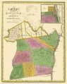
 AlbanyCounty1839.jpg 603 × 760; 103 KB
-
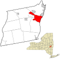
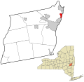
 Bethlehem Albany.png 1,170 × 800; 73 KB
-
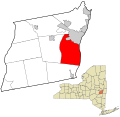
 Cohoes Albany.png 1,170 × 800; 73 KB
-

-
 Cohoes, N.Y. (2675026355).jpg 2,000 × 1,477; 2.65 MB
-
 Cohoes1891.jpg 420 × 400; 47 KB
-
 HannacroisCreek.png 457 × 405; 23 KB
-
-
 HurstvilleNY.jpg 420 × 400; 39 KB
-
 Map of New York highlighting Albany County.svg 6,599 × 5,030; 112 KB
-
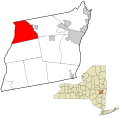
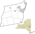
 New Scotland Albany.png 1,170 × 800; 73 KB
-
 NormansKill.png 705 × 413; 40 KB
-

-
 Rensselaerswyck 1767 Downsampled.png 2,000 × 1,422; 3.07 MB
-
 Rensselaerswyck 1767.png 2,854 × 2,029; 6.35 MB
-
 Sauthier Albany County.jpg 600 × 523; 85 KB
-
 New York State Senate District 44 (2012).png 3,259 × 2,492; 398 KB
-
 New York State Senate District 46 (2012).png 3,259 × 2,492; 404 KB
-
 VlomanKill.png 307 × 277; 15 KB
-
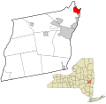
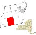
 Watervliet Albany.png 1,170 × 800; 73 KB
-
 Westmere Fire District Map.jpg 1,687 × 1,276; 646 KB


_highlighted.svg)


,_Locks_37_and_38,_84_North_Mohawk_Street,_Cohoes,_Albany_County,_NY_HAER_NY-337_(sheet_3_of_6).png)
.jpg)


.jpg)


.png)
.png)


