Category:Maps of Antalya Province
Wikimedia category | |||||
| Upload media | |||||
| Instance of | |||||
|---|---|---|---|---|---|
| Category combines topics | |||||
| Antalya Province | |||||
province on the Mediterranean coast of south-west Turkey .svg)   | |||||
| Instance of | |||||
| Part of |
| ||||
| Named after | |||||
| Location | Turkey | ||||
| Capital | |||||
| Population |
| ||||
| Area |
| ||||
| Different from | |||||
| official website | |||||
 | |||||
Subcategories
This category has the following 6 subcategories, out of 6 total.
Media in category "Maps of Antalya Province"
The following 18 files are in this category, out of 18 total.
-
 Anatolian regions.png 625 × 379; 515 KB
-
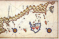
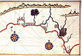 Antalya by Piri Reis.jpg 816 × 560; 429 KB
-
 Antalya harita.svg 1,052 × 744; 44 KB
-
 Antalya Merkez.png 800 × 446; 138 KB
-
 Antalya topographic location map.png 984 × 564; 823 KB
-
 Cape Adrasan and the Riviera of Finike by Piri Reis.jpg 549 × 814; 201 KB
-
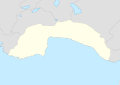
 Demre location in Antalia province on a map of Turkey.jpg 450 × 339; 35 KB
-
 Gazipasa Turkey locator.gif 579 × 262; 7 KB
-
-
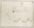
 Karamania Chart III from Cape Karaboornoo to Cape Anamour. RMG F0138.tiff 6,657 × 5,372; 102.31 MB
-
 Karstkomplex Antalya-Kestel.jpg 782 × 1,102; 440 KB
-
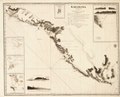
 Kas and Kastelorizo by Piri Reis.jpg 812 × 545; 575 KB
-
 Kesik Beli-Karawanenroute.jpg 764 × 1,051; 282 KB
-
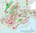 Landnutzungsmuster im Yavu-Bergland.jpg 3,343 × 3,089; 1.44 MB
-
 Latrans-Turkey location Antalya.svg 1,473 × 655; 10.88 MB
-
 Map of fazelis.jpg 1,511 × 2,004; 1.17 MB
-
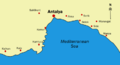 MapOfAntalyaTurkey.png 426 × 231; 21 KB
-
 Siedlungskarte des Yavu-Berglandes 12.07.2013.jpg 2,337 × 2,146; 544 KB


