Category:Maps of Attendorn
Media in category "Maps of Attendorn"
The following 18 files are in this category, out of 18 total.
-
 1573 Attendorn im Brüsseler Atlas.png 1,403 × 881; 2.58 MB
-
 1692 Attendorn, Ewig, Langenohl.jpg 2,023 × 1,374; 1.02 MB
-
 1725 Gericht Attendorn, Ämter Bilstein und Waldenburg.jpg 1,134 × 747; 462 KB
-
 1781 Attendorn, alter Hammerplatz.png 925 × 615; 1.2 MB
-
 1818 Karte Domänengut Ewig.jpg 9,820 × 5,344; 8.43 MB
-
 1836 Biggen.jpg 2,861 × 1,698; 2.41 MB
-
 1836 Karte westlich Attendorn.jpg 2,248 × 1,705; 2.22 MB
-
 1836 Langenohl.jpg 2,802 × 1,690; 2.59 MB
-
 1836 Lichtringhausen Windhausen.jpg 1,855 × 1,497; 1.71 MB
-
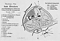
 1930 Stadt Attendorn, Attendorn-Land.png 935 × 672; 1.09 MB
-
 1966 Karte Biggesee.png 573 × 700; 673 KB
-
 Attendorn 1810.png 7,421 × 5,359; 37.84 MB
-
 Attendorn Situations-Plan.jpg 2,718 × 1,850; 1 MB
-
 Attendorn Stadt.jpg 800 × 640; 56 KB
-
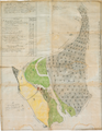 Gut Langenohl 1751.png 4,724 × 6,092; 29.54 MB
-
 Historika25 Attendornl 1840.jpg 947 × 791; 1.42 MB
-
 Lage der Stadt Attendorn in Deutschland.png 188 × 235; 5 KB
-
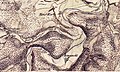
 Riff Attendorn Elspe 1.jpg 800 × 664; 395 KB


