Category:Maps of Baltimore County, Maryland
Counties of Maryland: Allegany · Anne Arundel · Baltimore · Calvert · Caroline · Carroll · Cecil · Charles · Dorchester · Frederick · Garrett · Harford · Howard · Kent · Montgomery · Prince George's · Queen Anne's · Somerset · St. Mary's · Talbot · Washington · Wicomico · Worcester · Independent city:
Wikimedia category | |||||
| Upload media | |||||
| Instance of | |||||
|---|---|---|---|---|---|
| Category combines topics | |||||
| Baltimore County | |||||
county in Maryland, United States     | |||||
| Instance of | |||||
| Part of | |||||
| Named after | |||||
| Location | Maryland | ||||
| Located in or next to body of water |
| ||||
| School district | |||||
| Capital | |||||
| Inception |
| ||||
| Population |
| ||||
| Area |
| ||||
| Different from | |||||
| official website | |||||
 | |||||
Subcategories
This category has the following 2 subcategories, out of 2 total.
Media in category "Maps of Baltimore County, Maryland"
The following 21 files are in this category, out of 21 total.
-

-
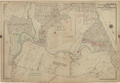 Atlas of Baltimore County, Maryland 1915 - Plate 9, Part of 1st and 2nd Districts.png 8,194 × 5,675; 19.39 MB
-
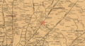
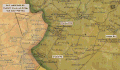
 Baltimore county (1929) (19730687154).jpg 2,996 × 3,383; 3.46 MB
-
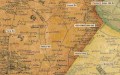
 Baltimore county (1929) (20165381500).jpg 2,976 × 3,300; 3.01 MB
-
 Baltimore county (1929) (20327077156).jpg 1,946 × 3,206; 758 KB
-
 Baltimore County, Maryland LOC 81690004.jpg 6,174 × 7,396; 5.97 MB
-
 Baltimore County, Maryland LOC 81690004.tif 6,174 × 7,396; 130.64 MB
-
 Baltimore East Quadrangle - NARA - 118818153.jpg 6,912 × 8,423; 5.91 MB
-
 Baltimore-Hamilton-Military-Map-1863.png 1,980 × 1,080; 3.98 MB
-
 Baltimore-Towson Metropolitan Area.png 566 × 311; 22 KB
-
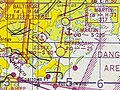 Essex MD 47sect.JPG 417 × 314; 33 KB
-
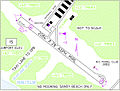 Essex Skypark-DIR 2011.jpg 600 × 457; 265 KB
-
 Jones Falls Valley Map.png 6,802 × 10,444; 1.24 MB
-
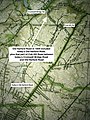 Map Balto topo 1939 Old Harford & Cub Hill Rds IMG 5941.jpg 1,722 × 2,296; 1.08 MB
-
 Map MD Griffith1794 OldHarfordRd wideLABELED.jpg 640 × 480; 193 KB
-
 Map MD Sidney1850 OldHarfordRd 6LABELED.jpg 1,280 × 675; 470 KB
-
 Map MD Sidney1850 OldHarfordRd middle LABELEDcrop.GIF 1,373 × 802; 712 KB
-
 Map MD Sidney1850 OldHarfordRd north LABELEDcrop.GIF 1,258 × 718; 560 KB
-
 Map MD Sidney1850 OldHarfordRd south LABELEDcrop.GIF 1,352 × 841; 832 KB
-
 Map of Maryland highlighting Baltimore County.svg 3,858 × 2,019; 139 KB
-
 Patapsco Valley Watershed Map.png 6,787 × 5,871; 1.4 MB


_(19730687154).jpg)
_(20165381500).jpg)
_(20327077156).jpg)


