<nowiki>Category:Maps of Banten; categoría de Wikimedia; kategori Wikimedia; Wikimedia category; د ويکيمېډيا وېشنيزه; Vikimedya kategorisi; ویکیمیڈیا زمرہ; kategória projektov Wikimedia; категорія проєкту Вікімедіа; 维基媒体分类; Wikimedia-Kategorie; Викимедиина категорија; kategorija na Wikimediji; विकिपीडिया:श्रेणी; page de catégorie de Wikimedia; kategorija na Wikimediji; विकिपीडिया वर्ग; категорија на Викимедији; Wikimedia-Kategorie; Wikimedia-kategori; kategori Wikimédia; تصنيف ويكيميديا; pajenn rummata eus Wikimedia; Wikimedia:ကဏ္ဍခွဲခြင်း; 維基媒體分類; Wikimedia категориясы; categoría de Wikimedia; categoria de Wikimedia; Wikimedia-Kategorie; tudalen categori Wikimedia; Viciméid catagóir; Վիքիմեդիայի նախագծի կատեգորիա; 维基媒体分类; Wikimedia-kategory; ვიკიპედია:კატეგორიზაცია; ウィキメディアのカテゴリ; categoria Wikimedia; تصنيف بتاع ويكيميديا; විකිමීඩියා ප්රභේද පිටුව; categoria Vicimediorum; Vikipidiya:Shopni; Wikimedia-luokka; Wikimedia-categorie; guruhi Vikimedia; катэгорыя ў праекце Вікімэдыя; Викимедиа проектындагы төркем; catigurìa di nu pruggettu Wikimedia; หน้าหมวดหมู่วิกิมีเดีย; Wikimedia:Kategorija; Wikimedia-Kategorie; Wikimedia:Klassys; категория на Уикимедия; categorie a unui proiect Wikimedia; categurìa 'e nu pruggette Wikimedia; Wikimedia-kategori; kawan Wikimèdia; 維基媒體分類; 위키미디어 분류; Wikimedia-bólkur; kategorio en Vikimedio; kategori Wikimedia; Wikimedia:Ronnaghys; উইকিমিডিয়া বিষয়শ্রেণী; kategori Wikimedia; 维基媒体分类; וויקימעדיע קאַטעגאָריע; kategorija w projektach Wikimedije; thể loại Wikimedia; Wikimedia projekta kategorija; kategoria ti Wikimedia; categoria de um projeto da Wikimedia; Wikimedia category; категорияд Ангилал; Wikimedia-kategori; kategori Wikimedia; پۆلی ویکیمیدیا; Wikimedia category; Vikimédia ñemohenda; Wikimédia-kategória; વિકિપીડિયા શ્રેણી; Wikimediako kategoria; категория в проекте Викимедиа; Wikimedia-Kategorie; катэгорыя ў праекце Вікімедыя; Wikimedia-kategorie; Wîkîmediya:Kategorî; विकिमिडिया श्रेणी; Wikimedia-Kategorie; קטגוריה במיזמי ויקימדיה; Викимедиа проектындагы төркем; Wikimedia-categorie; विकिमिडिया श्रेणी; 维基媒体分类; Wikimedia-kategoriija; гурӯҳи Викимедиа; kategoria w projekcie Wikimedia; Wikimedia category; categoría de Wikimedia; categoria di un progetto Wikimedia; 維基媒體分類; விக்கிமீடியப் பகுப்பு; 维基媒体分类; Wikimedia kategooria; 維基媒體分類; Wikimedia-kategori; kategorya ng Wikimedia; гурӯҳи Викимедиа; ẹ̀ka Wikimedia; kategorie na projektech Wikimedia; categoria de um projeto da Wikimedia; Wikimedia-Kategorie; ردهٔ ویکیپدیا; tumbung Wikimedia; Wikimedia-kategorie; kategorija Wikimedije; Wikimedia proyektındağı törkem; Викимедиа категорияһы; Kategoriya ning Wikimedia; kategori Wikimedia; jamii ya Wikimedia; വിക്കിമീഡിയ വർഗ്ഗം; Wikimedia-categorie; kategori Wikimedia; Wikimedia-Kategorie; زمرو:وڪيپيڊيا زمرا بندي; 維基媒體分類; categoría de Wikimedia; kategori e Wikimedias; κατηγορία εγχειρημάτων Wikimedia; विकिमीडिया श्रेणी</nowiki>
Category:Maps of Banten Wikimedia category
Upload media Instance of Category combines topics Banten province of Indonesia
Instance of Location Located in or next to body of water Capital Official language Head of government Inception Population Area Elevation above sea level Different from official website 6° 30′ 00″ S, 106° 15′ 00″ E
This is a
main category requiring frequent
diffusion and maybe maintenance . As many pictures and media files as possible should be moved into appropriate subcategories.
Subcategories
This category has the following 6 subcategories, out of 6 total.


 Banten map blank.png 245 × 161; 3 KB
 Banten Province Map.png 8,858 × 8,858; 8.93 MB
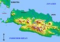 Batavia-Bandung.jpg 848 × 598; 101 KB
 Bayah Map Location.jpg 1,867 × 1,425; 313 KB
 IndonesiaBanten.png 800 × 375; 97 KB
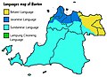 Languages map of Banten.jpg 3,264 × 2,374; 916 KB
 Locator banten.png 300 × 172; 18 KB
 Locator Kecamatan Curug di Kabupaten Tangerang.png 800 × 455; 83 KB
 Locator Kecamatan Pondok Aren di Kabupaten Tangerang.png 840 × 478; 14 KB
 Map of Banten region Wikivoyage.png 622 × 588; 60 KB
 Peta Banten Utara.png 479 × 395; 30 KB
 Peta Pembagian SWP Kota Tangerang Selatan 2022 (cropped).jpg 7,620 × 6,337; 6.07 MB
 Peta Pembagian SWP Kota Tangerang Selatan 2022.jpg 9,935 × 7,016; 9.46 MB
 Peta Sistem Pelayanan Kota Tangerang Selatan 2011.jpg 4,890 × 3,436; 4.65 MB
 Prov. Banten.jpg 1,280 × 1,280; 300 KB
 Pulau Tunda.jpg 2,340 × 1,655; 261 KB
 Regency results Banten election.png 245 × 161; 3 KB
 South Banten map.png 583 × 417; 21 KB


.jpg)


