Category:Maps of Beersheba
Subcategories
This category has the following 3 subcategories, out of 3 total.
M
- Maps of the battle of Beersheba (17 F)
O
- OpenStreetMap maps of Beersheba (14 F)
Media in category "Maps of Beersheba"
The following 22 files are in this category, out of 22 total.
-
 Battle of Beersheba map-HE.png 800 × 656; 46 KB
-
 Beer sheva-pos.png 277 × 749; 30 KB
-
 Beer-Sheva-Israël.jpg 320 × 595; 59 KB
-
 Beersheba 1945.jpg 758 × 737; 292 KB
-
 Beersheba 1947.jpg 4,575 × 3,076; 4.02 MB
-
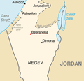 Beersheba Israel Map.png 285 × 275; 10 KB
-
 Beersheba OSM (1).svg 671 × 860; 2.95 MB
-
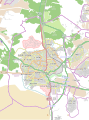 Beersheba OSM.svg 611 × 823; 2.29 MB
-
 Beersheba, Monument to Negev Brigade, Maps 01.jpg 2,304 × 3,072; 1.07 MB
-
 BeershebaNorthNegev.svg 2,100 × 1,360; 543 KB
-
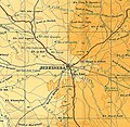
 BeershevaRegion1940s.jpg 1,126 × 1,128; 435 KB
-
 Berseeva capital of negev.jpg 1,296 × 968; 202 KB
-
 Dsad.JPG 989 × 521; 79 KB
-
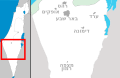
 Israel Beersheba location map.svg 549 × 625; 17 KB
-
 Localització de Beerxeba.png 300 × 200; 8 KB
-
 Map of Beerseva cs.png 300 × 200; 62 KB
-
 Old city of Beer Sheva En.jpg 1,635 × 1,557; 368 KB
-
 Old city of Beer Sheva-Blanco.jpg 1,635 × 1,557; 185 KB
-
 Old city of Beer Sheva-HE.png 1,635 × 1,557; 592 KB
-
 הסבר שכונת נחל בקע.jpg 1,833 × 777; 1.27 MB
-
 הסבר של שכונת נחל בקע.jpg 1,620 × 717; 615 KB
-
 רובעי רמזור באר שבע.png 2,481 × 1,754; 1,017 KB


.svg)


