Category:Maps of Berlin-Mitte
Wikimedia category | |||||
| Upload media | |||||
| Instance of | |||||
|---|---|---|---|---|---|
| Category combines topics | |||||
| Mitte | |||||
locality in the borough of Mitte, Berlin, Germany .jpg) _Flag.svg) _COA.svg)   | |||||
| Pronunciation audio | |||||
| Instance of |
| ||||
| Location |
| ||||
| Population |
| ||||
| Area |
| ||||
| Elevation above sea level |
| ||||
| Follows | |||||
| Replaced by | |||||
| Different from | |||||
 | |||||
Media in category "Maps of Berlin-Mitte"
The following 76 files are in this category, out of 76 total.
-
 3-D map of the Berlin Wall running through Berlin (7122164177).jpg 3,264 × 2,448; 2.48 MB
-
 595px berlin-mitte juedenstr.jpg 595 × 599; 156 KB
-
 Alt-Berlin 1893.jpg 651 × 592; 134 KB
-
 Ancienne rue de Berlin, la "Alte Schützenstraße" - Extrait du plan Baedeker 1914.png 1,635 × 912; 2.71 MB
-
 Bannmeile Bundestag Berlin.png 850 × 952; 568 KB
-
 Berlin 1847 Detail-Schloss.jpg 254 × 264; 54 KB
-
 Berlin 1847 Detail.jpg 1,545 × 1,466; 1.14 MB
-
 Berlin Dönhoffplatz Lageplan.png 2,308 × 1,336; 492 KB
-
 Berlin Heilige Geist Viertel map c 1927 (49967934462).jpg 2,749 × 2,196; 1.88 MB
-
 Berlin Hundebrücke 1652.jpg 1,595 × 873; 724 KB
-
 Berlin Kaiser Wilhelm Nationaldenkmal Lageplan.jpg 2,721 × 1,930; 824 KB
-
 Berlin Kurfuerstliche Residenz 1652.jpg 1,595 × 873; 1.4 MB
-
 Berlin Map Mitte.png 554 × 547; 465 KB
-
 Berlin Markthalle III Lageplan.jpg 1,088 × 794; 286 KB
-
 Berlin Markthalle IV Lageplan.jpg 1,895 × 1,149; 826 KB
-
 Berlin Mitte map with listings.png 3,507 × 2,480; 1.34 MB
-
 Berlin Mitte map with listings.svg 420 × 296; 10.58 MB
-
 Berlin Mitte Mitte.png 837 × 750; 67 KB
-
 Berlin vor 1920.png 2,637 × 2,267; 345 KB
-
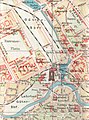
 Berlin Zentrum Pharus Plan 1902.jpg 3,500 × 2,572; 10.61 MB
-
 Berlin-lustgarten-map-Mario Duhanic.png 1,600 × 1,354; 146 KB
-
 Berlin-Mitte - geo.hlipp.de - 6422.jpg 480 × 640; 89 KB
-
 Berlin-Mitte Karte.png 869 × 752; 671 KB
-
 Berliner Stadt+Festungsmauer-today.jpg 600 × 600; 165 KB
-
 Berliner Stadtmauer-Festungstore.png 600 × 600; 845 KB
-
 Berliner Stadtschloss 1740 (Schleuen).jpg 378 × 467; 192 KB
-

-
 BerlinMap.jpg 735 × 525; 296 KB
-
 BlnVerbindungsb.jpg 935 × 653; 232 KB
-
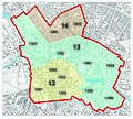 BMA Bezirksregionen Berlin-Mitte.jpg 2,368 × 2,132; 5.66 MB
-
 BMA Fischerinsel Berlin-Mitte.jpg 2,036 × 1,840; 4.61 MB
-
 BMA Nikolaiviertel Berlin-Mitte.jpg 2,047 × 1,840; 4.92 MB
-
 BMA Scheunenviertel Berlin-Mitte.jpg 2,031 × 1,842; 4.7 MB
-
 BMA Stadtbezirke Berlin Koelln.jpg 2,219 × 1,855; 5.23 MB
-
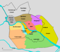
 BMA Stadtteile Berlin-Mitte.jpg 2,348 × 2,116; 5.43 MB
-
 BMA Stadtviertel Stadtkern Berlin.jpg 2,039 × 1,836; 4.78 MB
-
 Deu-frz Doppelkirche Lageplan 1811 (Selter)-var.jpg 1,704 × 1,116; 504 KB
-
 Doenhoffplatz Lageskizze.jpg 375 × 226; 15 KB
-
 Forum Fridericianum1-cropped.png 537 × 540; 25 KB
-
 Map de-be friedrichstadt.png 985 × 1,075; 353 KB
-
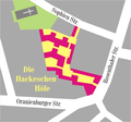 HackescheHöfe 4.png 598 × 557; 61 KB
-
 HackescheHöfe 5.png 598 × 557; 23 KB
-
 Jannowitzbrücke.png 552 × 488; 93 KB
-
 Karte berlin akzisemauer.png 1,200 × 864; 337 KB
-
 Karte berlin auswaertigesamt.png 1,200 × 1,209; 409 KB
-
 Karte berlin graueskloster.png 1,200 × 1,209; 591 KB
-
 Karte berlin klosterstrasse.jpg 1,200 × 1,209; 361 KB
-
 Karte berlin klosterstrasse.png 1,200 × 1,209; 368 KB
-
 Karte berlin museumsinsel.png 1,200 × 1,209; 861 KB
-
 Karte berlin stadthaus3.png 1,200 × 1,209; 481 KB
-
 Karte berlin stadtschloss.png 1,200 × 1,209; 680 KB
-
 Karte der Spandauer Straße in Berlin.png 1,658 × 1,399; 1.06 MB
-
 Karte des Südteils der Karl-Liebknecht-Straße in Berlin.png 2,072 × 1,749; 1.41 MB
-
 Karte4 Spreebogen.JPG 342 × 441; 32 KB
-
 Koppenplatz 1849.png 868 × 670; 1.26 MB
-
 Koppenplatz 1910.png 1,429 × 1,242; 2.78 MB
-
 Köllnischer Park auf OSM - fec Angela Monika Arnold, Berlin.png 539 × 487; 93 KB
-
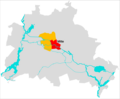 Lage Mitte.png 1,833 × 1,514; 165 KB
-
 Lagekarte des Fernsehturms in Berlin.png 2,072 × 1,749; 1.41 MB
-
 Luisenstaedtischer kanal.svg 1,201 × 2,100; 736 KB
-
 ZLB-Berliner Ansichten-April.jpg 4,961 × 3,390; 6.6 MB
-
 Richter 1915 Ausschnitt Berlin-Mitte.jpg 3,988 × 5,375; 4.22 MB
-
 Schloßplatz Funktionen.pdf 4,966 × 7,020; 2.62 MB
-
 Schloßplatz Funktionen.png 8,344 × 11,794; 22.04 MB
-
 Spandauer Vorstadt Dusableau 1723.jpg 1,080 × 842; 882 KB
-
 St Michael Berlin Pharus Plan.JPG 500 × 500; 99 KB
-
 Stadtplan museumsinsel.jpg 596 × 612; 252 KB
-
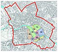
 Stadtviertel in Berlin-Mitte.png 1,300 × 1,300; 176 KB
-
 Steinert & Hansen Weingrosshandlung, 1891.jpg 693 × 1,076; 312 KB
-
 Stettiner Bahnhof.png 2,172 × 2,092; 767 KB
-
 Straubeplan Berliner Schloss.jpg 1,024 × 768; 258 KB
-
 Straubeplan Forum Fridericianum.jpg 1,024 × 768; 265 KB
-
 Straubeplan Heiliggeistviertel.jpg 1,024 × 768; 316 KB
-
 Straßenbild Neu Friedrichstraße anno 1925 aus Adressbuch.jpg 323 × 1,009; 199 KB
-
 Three Administration Buildings Comparison.png 602 × 571; 147 KB
-
 U-Bahn Berlin 1908 Trassierung Leipziger Platz Spittelmarkt.JPG 657 × 333; 127 KB
.jpg)


.jpg)


.jpg)


-var.jpg)


