Category:Maps of Bourbon County, Kansas
Counties of Kansas: Allen · Anderson · Atchison · Barber · Barton · Bourbon · Brown · Butler · Chase · Chautauqua · Cherokee · Cheyenne · Clark · Clay · Cloud · Coffey · Comanche · Cowley · Crawford · Decatur · Dickinson · Doniphan · Douglas · Edwards · Elk · Ellis · Ellsworth · Finney · Ford · Franklin · Geary · Gove · Graham · Grant · Gray · Greeley · Greenwood · Hamilton · Harper · Harvey · Haskell · Hodgeman · Jackson · Jefferson · Jewell · Johnson · Kearny · Kingman · Kiowa · Labette · Lane · Leavenworth · Lincoln · Linn · Logan · Lyon · Marion · Marshall · McPherson · Meade · Miami · Mitchell · Montgomery · Morris · Morton · Nemaha · Neosho · Ness · Norton · Osage · Osborne · Ottawa · Pawnee · Phillips · Pottawatomie · Pratt · Rawlins · Reno · Republic · Rice · Riley · Rooks · Rush · Russell · Saline · Scott · Sedgwick · Seward · Shawnee · Sheridan · Sherman · Smith · Stafford · Stanton · Stevens · Sumner · Thomas · Trego · Wabaunsee · Wallace · Washington · Wichita · Wilson · Woodson · Wyandotte
Wikimedia category | |||||
| Upload media | |||||
| Instance of | |||||
|---|---|---|---|---|---|
| Category combines topics | |||||
| Bourbon County | |||||
county in Kansas, United States   | |||||
| Instance of | |||||
| Named after | |||||
| Location | Kansas | ||||
| Capital | |||||
| Inception |
| ||||
| Population |
| ||||
| Area |
| ||||
| Different from | |||||
| official website | |||||
 | |||||
Media in category "Maps of Bourbon County, Kansas"
The following 21 files are in this category, out of 21 total.
-
-

-

-

-

-

-
 Kansas Senate District 12 (2010).png 3,507 × 2,190; 315 KB
-
 Kansas Senate District 13 (2010).png 3,507 × 2,190; 313 KB
-
 Map highlighting Drywood Township, Bourbon County, Kansas.svg 512 × 512; 27 KB
-
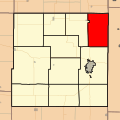
 Map highlighting Franklin Township, Bourbon County, Kansas.svg 512 × 512; 36 KB
-
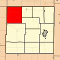
 Map highlighting Freedom Township, Bourbon County, Kansas.svg 512 × 512; 45 KB
-
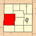 Map highlighting Marion Township, Bourbon County, Kansas.svg 512 × 512; 53 KB
-
 Map highlighting Marmaton Township, Bourbon County, Kansas.svg 512 × 512; 61 KB
-
 Map highlighting Mill Creek Township, Bourbon County, Kansas.svg 512 × 512; 70 KB
-
 Map highlighting Osage Township, Bourbon County, Kansas.svg 512 × 512; 79 KB
-
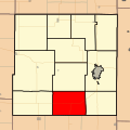 Map highlighting Pawnee Township, Bourbon County, Kansas.svg 512 × 512; 87 KB
-
 Map highlighting Scott Township, Bourbon County, Kansas.svg 512 × 512; 114 KB
-
 Map highlighting Timberhill Township, Bourbon County, Kansas.svg 512 × 512; 102 KB
-
 Map highlighting Walnut Township, Bourbon County, Kansas.svg 512 × 512; 112 KB
-
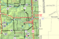 Map of Bourbon Co, Ks, USA.png 1,146 × 762; 337 KB
-
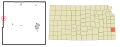
 Map of Kansas highlighting Bourbon County.svg 6,607 × 3,388; 24 KB
.png)
.png)


