Category:Maps of Bretagne
Administrative regions and territorial collectivity of Metropolitan France (‡ since start of 2016):
Auvergne-Rhône-Alpes‡ · Bourgogne-Franche-Comté‡ · Brittany · Centre-Val de Loire · Corsica · Grand Est‡ · Hauts-de-France‡ · Île-de-France · Normandy‡ · New Aquitaine‡ · Occitania‡ · Pays de la Loire · Provence-Alpes-Côte d'Azur
Former administrative regions of Metropolitan France (until end of 2015):
Alsace · Aquitaine · Auvergne · Burgundy · Champagne-Ardenne · Franche-Comté · Languedoc-Roussillon · Limousin · Lorraine · Midi-Pyrénées · Nord-Pas-de-Calais · Lower Normandy · Upper Normandy · Picardy · Poitou-Charentes · Rhône-Alpes
Overseas departments and regions: Guadeloupe · Martinique · French Guiana · Réunion · Mayotte
Overseas collectivities: Saint Barthélemy · Saint-Martin · Saint Pierre and Miquelon · French Polynesia · Wallis and Futuna · French Southern and Antarctic Lands+
Sui generis territories: New Caledonia · Clipperton Island+
Wikimedia category | |||||
| Upload media | |||||
| Instance of | |||||
|---|---|---|---|---|---|
| Category combines topics | |||||
| Brittany | |||||
cultural area located in northwestern France  .svg)   | |||||
| Pronunciation audio | |||||
| Instance of | |||||
| Part of | |||||
| Named after | |||||
| Location |
| ||||
| Anthem | |||||
| Has part(s) |
| ||||
| Highest point | |||||
| Population |
| ||||
| Area |
| ||||
| Top-level Internet domain |
| ||||
| Different from | |||||
 | |||||
Subcategories
This category has the following 18 subcategories, out of 18 total.
Media in category "Maps of Bretagne"
The following 56 files are in this category, out of 56 total.
-
 1789 + 2022 Bretagne, noms.png 1,135 × 873; 101 KB
-
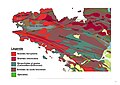
 53-Bretagne-climat5Z.png 3,519 × 2,930; 1.65 MB
-
 Blavet.png 447 × 450; 454 KB
-
 Breizh5sur5 2018-11-07.png 3,467 × 3,161; 1.6 MB
-
 Bretagne - Carte gastronomique de la France, Bourguignon Alain.jpg 3,462 × 2,870; 1.84 MB
-
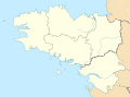 Bretagne 5 departements location map.svg 532 × 393; 252 KB
-
 Bretagne historique et culturelle.png 624 × 600; 89 KB
-
 Brittany - France.png 514 × 480; 11 KB
-
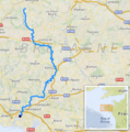
 Canal de Nantes à Brest 01 1.png 688 × 547; 337 KB
-
 Carte 1re étape TDF 1952.png 3,126 × 2,140; 556 KB
-
 Carte 2e étape TDF 1952.png 3,126 × 2,140; 698 KB
-
 Carte Bretagne2.jpg 225 × 244; 7 KB
-

-
 Carte Galette saucisse.png 3,067 × 2,600; 825 KB
-
 Carte géologique de Bubry.jpg 1,123 × 794; 87 KB
-
 Carte géologique de Ploumanac'h.png 1,770 × 1,340; 750 KB
-
 Carte LGV Sud-Loire.png 546 × 435; 55 KB
-
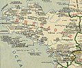
 Carte localisation FICP 1828.jpg 1,403 × 992; 387 KB
-
 Carte opérateur bassin Vilaine.jpg 1,200 × 849; 293 KB
-
 Carte puzzle départements bretons.png 1,644 × 1,464; 608 KB
-
 Carte sites Kermené.jpg 499 × 351; 24 KB
-
 CarteregionBretagne.jpg 500 × 500; 89 KB
-
 CelticNationsMap.jpg 464 × 678; 58 KB
-
 Chwe Chenedl Geltaidd syml gyda Baneri.svg 360 × 711; 210 KB
-
 Chwe Chenedl Geltaidd syml.png 360 × 711; 12 KB
-
 Chwe Chenedl Geltaidd.png 430 × 711; 12 KB
-
 Climat-Bretagne-2010-Joly.jpeg 4,677 × 3,307; 827 KB
-
 Climat-Bretagne-6Z.jpeg 4,677 × 3,307; 1.51 MB
-
 Climat-Bretagne-PCAET.jpeg 3,507 × 2,480; 615 KB
-
 Côte sauvage005.jpg 858 × 480; 66 KB
-
 Delwenn Nevenoe e Baen-Ballon 04.jpg 1,536 × 2,048; 729 KB
-
 Distribution relative des brittophones en 2004.png 617 × 408; 42 KB
-
 Distribution relative des brittophones par Pays (2004).png 617 × 408; 42 KB
-
 Ecoles FIC 1821.jpg 1,403 × 992; 271 KB
-
 ETH-BIB-Karte Bretagne-Normandie-Dia 247-Z-00444.tif 3,494 × 2,830; 28.39 MB
-
 EU location BZH.png 1,600 × 1,200; 716 KB
-
 Geologic map Armorican Massif BR.svg 1,770 × 1,340; 985 KB
-
 Geologic map Bay of Mont Saint-Michel FR.svg 1,770 × 1,340; 992 KB
-
 Geomorphologic map Morgat.jpg 600 × 445; 258 KB
-
 Kartenn OpenStreetMap e brezhoneg.png 1,246 × 879; 980 KB
-
 La Roche-Derrien. Localisation.jpg 227 × 196; 9 KB
-
 Laita affluents.png 2,349 × 2,986; 2.11 MB
-
 Le GR37 Coeur de Bretagne.png 1,928 × 662; 2.06 MB
-
 Lec'hiadur Breizh-Vras.png 414 × 516; 9 KB
-
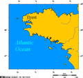
 LocationBretagne.png 250 × 115; 4 KB
-
 Map of Brittany with 5 regions Llydaw Breizh.png 563 × 405; 59 KB
-
 Nav bro breizh.png 12,424 × 9,169; 3.76 MB
-

-
 Oust (rivière).png 660 × 489; 748 KB
-
 Panellerezh 2ek galleg brezhoneg.jpg 575 × 427; 86 KB
-
 Panellerezh 2ek galleg gallaoueg.jpg 575 × 427; 82 KB
-
 Percentage of breton speakers in the breton countries in 2004.png 617 × 408; 42 KB
-
 Portrait de Jacques Pélissier.jpg 2,493 × 2,500; 3.28 MB
-
 Sillon de Bretagne.jpg 1,123 × 794; 85 KB
-
 Topographic map of Haute-Bretagne.png 1,601 × 1,822; 2.94 MB
-
 Zone de production du cidre breton (2014).svg 592 × 296; 4.98 MB


.png)


.png)


.png)


.svg)