Category:Maps of Buffalo National River
English: Maps of Buffalo National River
Wikimedia category | |||||
| Upload media | |||||
| Instance of | |||||
|---|---|---|---|---|---|
| Category combines topics | |||||
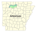
| Buffalo National River | |||||
national river in northern Arkansas, USA  | |||||
| Instance of |
| ||||
| Named after |
| ||||
| Location | Arkansas | ||||
| Operator | |||||
| Heritage designation |
| ||||
| IUCN protected areas category | |||||
| Different from | |||||
| official website | |||||
 | |||||
Media in category "Maps of Buffalo National River"
The following 27 files are in this category, out of 27 total.
-
 BuffaloPoint.png 371 × 387; 13 KB
-
 BuffGenLoc.png 300 × 266; 48 KB
-
 Buffws.png 780 × 570; 298 KB
-
 ComptonBoxley.png 343 × 511; 12 KB
-
 ErbieLoop.png 307 × 371; 11 KB
-
 NPS buffalo-boxley-ponca-trail-map.jpg 1,792 × 2,164; 1.22 MB
-
 NPS buffalo-carver-campground-map.gif 1,304 × 1,551; 90 KB
-
 NPS buffalo-cecil-cove-trail-map.jpg 1,352 × 888; 427 KB
-
 NPS buffalo-centerpoint-trail-map.jpg 1,358 × 896; 567 KB
-
 NPS buffalo-erbie-campground-map.gif 1,750 × 1,142; 151 KB
-
 NPS buffalo-erbie-ozark-trail-map.jpg 2,392 × 1,576; 1.11 MB
-
 NPS buffalo-hemmed-in-hollow-trail-map.jpg 1,019 × 1,234; 546 KB
-
 NPS buffalo-hide-out-hollow-trail-map.jpg 1,014 × 1,224; 350 KB
-
 NPS buffalo-kyles-landing-campground-map.gif 1,318 × 1,569; 162 KB
-
 NPS buffalo-kyles-landing-erbie-trail-map.jpg 2,394 × 1,580; 1.17 MB
-
 NPS buffalo-lost-valley-trail-map.jpg 1,356 × 882; 425 KB
-
 NPS buffalo-mill-creek-trail-map.jpg 1,014 × 1,228; 356 KB
-
 NPS buffalo-ozark-campground-map.gif 1,307 × 1,553; 142 KB
-
 NPS buffalo-ozark-pruitt-trail-map.jpg 2,396 × 1,582; 992 KB
-
 NPS buffalo-point-campground-map.gif 1,870 × 1,445; 181 KB
-
 NPS buffalo-ponca-steel-creek-trail-map.jpg 1,792 × 2,164; 1.26 MB
-
 NPS buffalo-river-map.jpg 3,486 × 1,650; 1.09 MB
-
 NPS buffalo-river-map.pdf 3,300 × 3,000; 1.12 MB
-
 NPS buffalo-river-vegetation-map.gif 6,864 × 4,922; 2.51 MB
-
 NPS buffalo-steel-creek-campground.gif 1,307 × 1,558; 139 KB
-
 NPS buffalo-steel-creek-kyles-landing-trail-map.jpg 2,418 × 1,612; 1.47 MB
-
 NPS buffalo-tyler-bend-campground-map.gif 1,598 × 1,218; 430 KB


