Category:Maps of Chonburi Province
Wikimedia category | |||||
| Upload media | |||||
| Instance of | |||||
|---|---|---|---|---|---|
| Category combines topics | |||||
| Chon Buri | |||||
province in eastern Thailand      | |||||
| Instance of | |||||
| Part of | |||||
| Location | Thailand | ||||
| Located in or next to body of water | |||||
| Capital | |||||
| Official language | |||||
| Currency | |||||
| Highest point |
| ||||
| Population |
| ||||
| Area |
| ||||
| official website | |||||
 | |||||
Subcategories
This category has only the following subcategory.
E
Media in category "Maps of Chonburi Province"
The following 34 files are in this category, out of 34 total.
-
 Admiralty Chart No 986 Approaches to Ao Udom, Published 1964.jpg 16,180 × 11,071; 43.54 MB
-
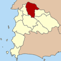
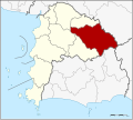
 Amphoe 2001.png 250 × 250; 8 KB
-
 Amphoe 2001.svg 744 × 666; 109 KB
-
 Amphoe 2002.png 250 × 250; 7 KB
-
 Amphoe 2002.svg 744 × 666; 111 KB
-
 Amphoe 2003.png 250 × 250; 8 KB
-
 Amphoe 2003.svg 744 × 666; 110 KB
-
 Amphoe 2004.png 250 × 250; 8 KB
-
 Amphoe 2004.svg 744 × 666; 110 KB
-
 Amphoe 2005.png 250 × 250; 8 KB
-
 Amphoe 2005.svg 744 × 666; 109 KB
-
 Amphoe 2006.png 250 × 250; 8 KB
-
 Amphoe 2006.svg 744 × 666; 110 KB
-
 Amphoe 2007.png 250 × 250; 8 KB
-
 Amphoe 2007.svg 744 × 666; 111 KB
-
 Amphoe 2008.png 250 × 250; 8 KB
-
 Amphoe 2008.svg 744 × 666; 107 KB
-
 Amphoe 2009.png 250 × 250; 8 KB
-
 Amphoe 2009.svg 744 × 666; 108 KB
-
 Amphoe 2010.png 250 × 250; 8 KB
-
 Amphoe 2010.svg 744 × 666; 112 KB
-
 Amphoe 2011.png 250 × 250; 8 KB
-
 Amphoe 2011.svg 744 × 666; 110 KB
-
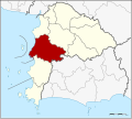
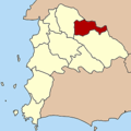
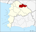
 Amphoe Chonburi.png 375 × 375; 17 KB
-
 Amphoe Chonburi.svg 733 × 659; 136 KB
-
 Chonburi PESA.svg 733 × 659; 129 KB
-
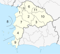
 Districts Chonburi.png 1,139 × 1,024; 209 KB
-
 Map BUU S.jpg 1,024 × 768; 202 KB
-
 Map BUU.jpg 2,476 × 2,152; 1.35 MB
-
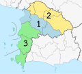
 Municipal Areas in Chon Buri Province EN.png 1,894 × 1,703; 588 KB
-
 Municipal Areas in Chon Buri Province TH.png 1,894 × 1,703; 599 KB
-
 Nong Kham Interchange.png 872 × 672; 364 KB
-
 Thailand Chon Buri location map.svg 733 × 659; 116 KB
-
 Thailand Chonburi locator map.svg 1,052 × 1,849; 1.24 MB


