Category:Maps of Collioure
Wikimedia category | |||||
| Upload media | |||||
| Instance of | |||||
|---|---|---|---|---|---|
| Category combines topics | |||||
| Collioure | |||||
commune in Pyrénées-Orientales, France    | |||||
| Pronunciation audio | |||||
| Instance of | |||||
| Location | |||||
| Head of government |
| ||||
| Significant event |
| ||||
| Population |
| ||||
| Area |
| ||||
| Elevation above sea level |
| ||||
| official website | |||||
 | |||||
Media in category "Maps of Collioure"
The following 12 files are in this category, out of 12 total.
-
 "Plan de la Ville et Port de Colioure" (22255330931).jpg 3,267 × 2,429; 1.71 MB
-
 66053-Collioure-argile.png 4,076 × 3,307; 7.62 MB
-
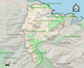
 66053-Collioure-Natura2000.png 5,846 × 4,133; 10.57 MB
-
 66053-Collioure-Routes-Hydro.png 3,507 × 2,480; 616 KB
-
 66053-Collioure-Sols.png 3,270 × 2,598; 2.23 MB
-
 66053-Collioure-ZNIEFF1.png 3,057 × 2,480; 5.77 MB
-
 66053-Collioure-ZNIEFF2.png 3,519 × 2,480; 5.75 MB
-
 66053-Collioure-Zone inondable.png 4,677 × 3,307; 8.82 MB
-
 AOC Banyuls.png 648 × 389; 13 KB
-
 Collioure AOC within Banyuls.jpg 648 × 389; 37 KB
-
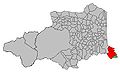
 Map commune FR insee code 66053.png 756 × 605; 69 KB
-
 Sarazin - Cartes ports 66.jpg 695 × 508; 53 KB
.jpg)


