Category:Maps of Erongo
Media in category "Maps of Erongo"
The following 9 files are in this category, out of 9 total.
-
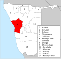 Namibia 14 regions-numbered-erongo.svg 700 × 675; 119 KB
-
 Namibia Regions Erongo 250px.png 250 × 254; 15 KB
-
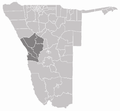 Region Erongo in Namibia.png 975 × 900; 149 KB
-
 Wahlkreis Brandberg in Erongo.png 975 × 900; 150 KB
-
 Wahlkreis Karibib in Erongo.png 975 × 900; 150 KB
-
 Wahlkreis Swakopmund in Erongo.png 975 × 900; 149 KB
-
 Wahlkreis Walfischbucht Land in Erongo.png 975 × 900; 150 KB
-
 Wahlkreis Walfischbucht Stadt in Erongo.png 975 × 900; 149 KB
-
 Wahlkreise Erongo.png 194 × 237; 23 KB


