Category:Maps of Fairfax County, Virginia
Counties of Virginia: Accomack · Albemarle · Alleghany · Amelia · Amherst · Appomattox · Arlington · Augusta · Bath · Bedford · Bland · Botetourt · Brunswick · Buchanan · Buckingham · Campbell · Caroline · Carroll · Charles City · Charlotte · Chesterfield · Clarke · Craig · Culpeper · Cumberland · Dickenson · Dinwiddie · Essex · Fairfax · Fauquier · Floyd · Fluvanna · Franklin · Frederick · Giles · Gloucester · Goochland · Grayson · Greene · Greensville · Halifax · Hanover · Henrico · Henry · Highland · Isle of Wight · James City · King and Queen · King George · King William · Lancaster · Lee · Loudoun · Louisa · Lunenburg · Madison · Mathews · Mecklenburg · Middlesex · Montgomery · Nelson · New Kent · Northampton · Northumberland · Nottoway · Orange · Page · Patrick · Pittsylvania · Powhatan · Prince Edward · Prince George · Prince William · Pulaski · Rappahannock · Richmond · Roanoke · Rockbridge · Rockingham · Russell · Scott · Shenandoah · Smyth · Southampton · Spotsylvania · Stafford · Surry · Sussex · Tazewell · Warren · Washington · Westmoreland · Wise · Wythe · York
Wikimedia category | |||||
| Upload media | |||||
| Instance of | |||||
|---|---|---|---|---|---|
| Category combines topics | |||||
| Fairfax County | |||||
county in Virginia, United States      | |||||
| Instance of | |||||
| Part of |
| ||||
| Named after | |||||
| Location | Virginia | ||||
| School district | |||||
| Capital | |||||
| Legislative body |
| ||||
| Inception |
| ||||
| Population |
| ||||
| Area |
| ||||
| Different from | |||||
| official website | |||||
 | |||||
Media in category "Maps of Fairfax County, Virginia"
The following 111 files are in this category, out of 111 total.
-
-

-

-

-

-

-

-

-

-

-

-

-

-

-

-
-

-
-

-

-

-

-

-

-
-
-

-

-

-

-

-
-

-

-

-
-

-
 Fairfax County Virginia Incorporated and Unincorporated Areas.svg 500 × 550; 228 KB
-
 Northern Neck Proprietary map.jpg 4,272 × 3,704; 10.54 MB
-
 1915 map Fairfax, Virginia.jpg 1,700 × 2,800; 1.74 MB
-
-
-

-
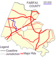
 Fairfax & Loudoun Counties with SR 606.png 705 × 511; 80 KB
-
 Fairfax & Loudoun Counties with SR 620.png 705 × 511; 80 KB
-
 Fairfax & Prince William Map with SR 612.png 705 × 511; 76 KB
-
 Fairfax and Loudoun with Major Roads.png 705 × 511; 58 KB
-
 Fairfax and Prince William with Major Roads.png 705 × 511; 75 KB
-
 Fairfax Area.svg 631 × 529; 827 KB
-

-
 Fairfax County, VA.png 414 × 780; 25 KB
-
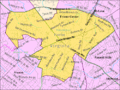
 Fairfax County2.png 386 × 283; 11 KB
-
 Fairfax Map with SR 602.png 401 × 419; 82 KB
-
 Fairfax Map with SR 608.png 401 × 419; 81 KB
-
 Fairfax Map with SR 645.png 401 × 419; 82 KB
-
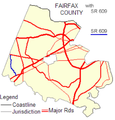 Fairfax with SR 609.png 401 × 419; 83 KB
-
 Fairfax.svg 896 × 666; 659 KB
-
 George Washington Memorial Parkway - Reference Map.jpg 8,310 × 6,462; 5.87 MB
-
 Herndon Virginia CDP.png 575 × 425; 60 KB
-

-

-
 Maneuver Grounds, Prince William and Fairfax Counties, Virginia - NARA - 137930514.jpg 13,559 × 10,796; 22.61 MB
-
 Maneuver Grounds, Prince William and Fairfax Counties, Virginia - NARA - 137930534.jpg 7,382 × 5,940; 7.4 MB
-
 Map 1861 Fairfax County.jpg 2,758 × 2,827; 4.67 MB
-
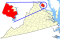
 Map of Virginia highlighting Fairfax County.svg 7,486 × 3,247; 386 KB
-
 Map showing Fairfax County, Virginia.png 750 × 485; 34 KB
-
 McLeanCDPmap.gif 500 × 375; 45 KB
-
 Rural Delivery Routes; Fairfax County, Va. LOC 2007627499.jpg 9,455 × 10,334; 7.83 MB
-
 TysonsCornerCDPmap.gif 500 × 375; 50 KB
-
 VAMap-doton-Annandale.png 300 × 134; 9 KB
-
 VAMap-doton-BelleHaven.png 300 × 134; 9 KB
-
 VAMap-doton-Burke.PNG 300 × 134; 9 KB
-
 VAMap-doton-Centreville.PNG 300 × 134; 9 KB
-
 VAMap-doton-Chantilly.PNG 300 × 134; 9 KB
-
 VAMap-doton-DunnLoring.PNG 300 × 134; 9 KB
-
 VAMap-doton-FairfaxStation.PNG 300 × 134; 9 KB
-
 VAMap-doton-FortBelvoir.PNG 300 × 134; 9 KB
-
 VAMap-doton-FortHunt.PNG 300 × 134; 9 KB
-
 VAMap-doton-Franconia.PNG 300 × 134; 9 KB
-
 VAMap-doton-GreatFalls.PNG 300 × 134; 9 KB
-
 VAMap-doton-Groveton.PNG 300 × 134; 9 KB
-
 VAMap-doton-Herndon.PNG 300 × 134; 9 KB
-
 VAMap-doton-Huntington.PNG 300 × 134; 9 KB
-
 VAMap-doton-Idylwood.PNG 300 × 134; 9 KB
-
 VAMap-doton-LakeBarcroft.PNG 300 × 134; 9 KB
-
 VAMap-doton-Lorton.PNG 300 × 134; 9 KB
-
 VAMap-doton-Mantua.PNG 300 × 134; 9 KB
-
 VAMap-doton-McLean.PNG 300 × 134; 9 KB
-
 VAMap-doton-Merrifield.PNG 300 × 134; 9 KB
-
 VAMap-doton-MountVernon.PNG 300 × 134; 9 KB
-
 VAMap-doton-Newington.PNG 300 × 134; 9 KB
-
 VAMap-doton-NorthSpringfield.PNG 300 × 134; 9 KB
-
 VAMap-doton-Oakton.PNG 300 × 134; 9 KB
-
 VAMap-doton-Reston.PNG 300 × 134; 9 KB
-
 VAMap-doton-SevenCorners.PNG 300 × 134; 9 KB
-
 VAMap-doton-Springfield.PNG 300 × 134; 9 KB
-
 VAMap-doton-TysonsCorner.PNG 300 × 134; 9 KB
-
 VAMap-doton-Vienna.PNG 300 × 134; 9 KB
-
 VAMap-doton-WestSpringfield.PNG 300 × 134; 9 KB
-
 Vicinity of Washington DC by Griffith Hopkins, 1894 (Jackson City detail crop).jpg 1,693 × 1,938; 867 KB
-
 Vicinity of Washington DC by Griffith Hopkins, 1894.jpg 18,600 × 18,600; 46.48 MB
-
 Vienna postal area and city limits.png 463 × 522; 65 KB
-
 Virginia Senate District 30 (2011).png 3,507 × 1,529; 680 KB
-
 Virginia Senate District 31 (2011).png 3,506 × 1,528; 681 KB
-
 Virginia Senate District 32 (2011).png 3,505 × 1,530; 680 KB
-
 Virginia Senate District 33 (2011).png 3,501 × 1,527; 680 KB
-
 Virginia Senate District 34 (2011).png 3,505 × 1,525; 680 KB
-
 Virginia Senate District 35 (2011).png 3,504 × 1,527; 680 KB
-
 Virginia Senate District 36 (2011).png 3,501 × 1,531; 682 KB
-
 Virginia Senate District 37 (2011).png 3,505 × 1,526; 681 KB
-
 Virginia Senate District 39 (2011).png 3,504 × 1,529; 681 KB


_-_Deed_drawn_LOC_2015587372.jpg)


.jpg)


.png)
.png)
.png)
.png)
.png)
.png)
.png)
.png)
.png)