Category:Maps of Fillière
Wikimedia category | |||||
| Upload media | |||||
| Instance of | |||||
|---|---|---|---|---|---|
| Category combines topics | |||||
| Fillière | |||||
commune in Haute-Savoie, France  | |||||
| Instance of |
| ||||
| Location |
| ||||
| Legal form |
| ||||
| Inception |
| ||||
| Population |
| ||||
| Area |
| ||||
| Replaces | |||||
| official website | |||||
 | |||||
Subcategories
This category has the following 2 subcategories, out of 2 total.
*
G
- Geological maps of Fillière (13 F)
Media in category "Maps of Fillière"
The following 13 files are in this category, out of 13 total.
-
 74282-Fillière - Localisation.png 3,507 × 2,480; 1.27 MB
-
 74282-Fillière-Cadastre.png 7,015 × 4,960; 19.6 MB
-
 74282-Fillière-Hydro.png 7,015 × 4,960; 11.21 MB
-
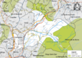
 74282-Fillière-Natura 2000.png 7,015 × 4,960; 9.45 MB
-
 74282-Fillière-Orthophoto.png 7,015 × 4,960; 48.32 MB
-
 74282-Fillière-Sols.png 7,015 × 4,960; 12.18 MB
-
 74282-Fillière-ZNIEFF1.png 7,015 × 4,960; 9.53 MB
-
 74282-Fillière-ZNIEFF2.png 7,015 × 4,960; 9.4 MB
-
 Map commune FR insee code 74022.png 756 × 605; 47 KB
-
 Map commune FR insee code 74120.png 756 × 605; 72 KB
-
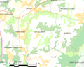 Map commune FR insee code 74204.png 756 × 605; 55 KB
-
 Map commune FR insee code 74245.png 756 × 605; 69 KB
-
 Map commune FR insee code 74282.png 756 × 605; 88 KB


