Category:Maps of Flanders
Wikimedia category | |||||
| Upload media | |||||
| Instance of | |||||
|---|---|---|---|---|---|
| Category combines topics | |||||
| Flanders | |||||
land of the Flemish people  L'hemicicle del Parlament flamenc a Brussel·les | |||||
| Pronunciation audio | |||||
| Instance of |
| ||||
| Location |
| ||||
| Different from | |||||
| official website | |||||
 | |||||
Use the appropriate category for maps showing all or a large part of Flanders. See subcategories for smaller areas:
| If the map shows | Category to use |
|---|---|
| Flanders on a recently created map | Category:Maps of Flanders or its subcategories |
| Flanders on a map created more than 70 years ago | Category:Old maps of Flanders or its subcategories |
| the history of Flanders on a recently created map | Category:Maps of the history of Flanders or its subcategories |
| the history of Flanders on a map created more than 70 years ago | Category:Old maps of the history of Flanders or its subcategories |
Subcategories
This category has the following 10 subcategories, out of 10 total.
Pages in category "Maps of Flanders"
This category contains only the following page.
Media in category "Maps of Flanders"
The following 60 files are in this category, out of 60 total.
-
 "Cronache de signiori di Fiandra", avec la plus ancienne carte de Flandre.jpg 2,560 × 1,920; 2.73 MB
-
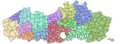
 15 regios met legende.png 760 × 469; 196 KB
-
 15 regios.png 762 × 349; 164 KB
-
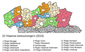
 15 Vlaamse Regio's (2023).png 2,353 × 870; 575 KB
-
 Agriculture characterisation map, Flanders (preview).jpeg 2,000 × 1,015; 343 KB
-
 Agriculture characterisation map, Flanders.png 16,211 × 8,225; 1.07 MB
-
 Aire de répartition Oie flamande.jpg 603 × 613; 203 KB
-
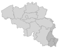
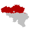
 Belgium region Flanders black.svg 307 × 251; 99 KB
-
 Belgiumlux.png 1,118 × 895; 135 KB
-
 Carte de typologie agricole, Flandre (preview).jpeg 2,000 × 1,008; 346 KB
-
 Carte de typologie agricole, Flandre.png 16,190 × 8,160; 1.11 MB
-
 Carte des pagi de Flandre en 933.png 4,590 × 3,806; 1.12 MB
-
 Centrumsteden.jpg 910 × 505; 231 KB
-
 Côte flamande.jpg 986 × 586; 155 KB
-
 Digitaal Hoogtemodel Vlaanderen.png 3,984 × 2,016; 2.63 MB
-
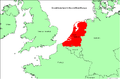
 Flanders (Belgium) location.svg 1,136 × 945; 133 KB
-
 Flanders in Europe.svg 680 × 520; 2.43 MB
-
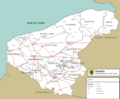
 Flanders travel map.png 2,999 × 1,170; 781 KB
-
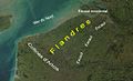 Flandres - géographie.jpg 1,121 × 679; 185 KB
-
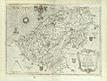
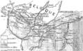
 Flandria Comit. (2).jpg 7,009 × 5,813; 11.85 MB
-
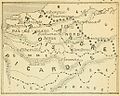
 Flandriae recens exactaque descriptio - RRA 3= 72. Pièce 11.jpg 2,286 × 1,726; 815 KB
-
 Flemish Community in Belgium and Europe.svg 680 × 520; 2.38 MB
-
 Flemish Region in Belgium and Europe.svg 680 × 520; 2.36 MB
-
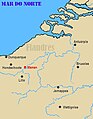
 France du Nord.PNG 744 × 455; 102 KB
-
 G. Bruno - Le Tour de la France par deux enfants p265h.jpg 1,032 × 828; 153 KB
-
 Ghent, Belgium, Devreese L.D., 1789.jpg 1,500 × 1,298; 643 KB
-
 Groot-Nederland in Europa.PNG 1,025 × 673; 41 KB
-
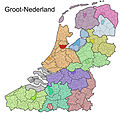 Grootnederland.jpg 2,000 × 1,922; 495 KB
-
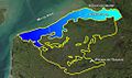
 Grote en Kleine Molenbeek.jpg 870 × 2,220; 226 KB
-
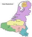 Heelnederland.png 1,212 × 1,385; 284 KB
-
 Kaart Graaf Jansdijk.PNG 1,268 × 633; 471 KB
-

-
 Kaart van de vredegerechtskantons in Vlaanderen (wet 2017).png 800 × 450; 43 KB
-

-
 Kaart van het Land van Waas.png 965 × 850; 67 KB
-
 Landbouwtyperingskaart 2012.JPG 952 × 560; 102 KB
-
 Location map for Flanders in Europe.PNG 720 × 600; 66 KB
-
 Menen - localização.jpg 395 × 507; 93 KB
-
 Plaine maritime flamande - Flandre maritime.jpg 986 × 586; 178 KB
-
 Plaine maritime flamande.jpg 986 × 586; 155 KB
-
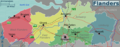
 Provinces of Flanders (he).svg 879 × 341; 18 KB
-
 Provinces of Flanders.svg 879 × 341; 17 KB
-
 ProvincesFlanders.png 270 × 135; 3 KB
-
 Region Flandern 2019.png 2,500 × 2,178; 916 KB
-
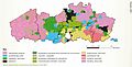
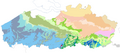
 Regionale Landschappen in Vlaanderen.png 2,092 × 1,586; 109 KB
-
 Regionale landschappen in Vlaanderen.png 4,184 × 3,172; 365 KB
-
 Regionale landschappen VL.png 3,984 × 1,504; 495 KB
-
 Reichsgau Flandern.svg 450 × 456; 509 KB
-
 RL OverzichtskaartA3 juni2019 FINAL.jpg 4,697 × 3,280; 5.99 MB
-
 Scheldevlakte.jpg 986 × 586; 164 KB
-
 Subcrop Quartair Vlaanderen.png 1,465 × 642; 370 KB
-
 Vereenvoudigde Quartairkaart Vlaanderen.png 1,477 × 631; 365 KB
-
 Vlaams GewestLocatie.png 270 × 270; 1,004 bytes
-
 Vlaams GewestLocatie.svg 307 × 251; 68 KB
-
 Vlaams Location.svg 307 × 251; 69 KB
-
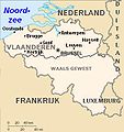 Vlaanderen-map.jpg 321 × 340; 19 KB
-
 VlaanderenProvincies.png 270 × 135; 3 KB
-
 Vlaenderen exactissima Flandriæ descriptio - RRA 3= 72. Pièce 12.jpg 3,178 × 2,318; 1.9 MB
-
 Wax-Belgium location Flemish Region.svg 510 × 407; 104 KB
-
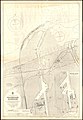 Admiralty Chart No 97 Zeebrugge Harbour, Published 1924.jpg 8,582 × 12,368; 36.85 MB


.jpeg)


.jpeg)


_location.svg)


.jpg)


.png)
.png)
,_RP-P-AO-18-35.jpg)


.png)
.svg)