Category:Maps of Fort Vancouver National Historic Site
Media in category "Maps of Fort Vancouver National Historic Site"
The following 20 files are in this category, out of 20 total.
-
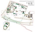
 Fort Vancouver National Historic Site map 2002.12.png 499 × 467; 19 KB
-
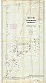
 Vancouver National Historic Reserve ownership map 2003.jpg 1,146 × 711; 429 KB
-
 1841 Oregon Territory LowRes (8746172306).jpg 11,857 × 8,100; 27.13 MB
-
 1854 Mansfield Map (9089505652).jpg 2,048 × 3,496; 635 KB
-
 1874 Ward Map (9087042953).jpg 2,024 × 2,712; 1.55 MB
-
 Fort Vancouver 1841map1 (14691546310).jpg 1,103 × 1,140; 853 KB
-
 Fort Vancouver 1841map2 (14691587149).jpg 731 × 484; 274 KB
-
 Fort Vancouver DSC00848a (14891994073).jpg 3,457 × 2,375; 2.1 MB
-
 Fort Vancouver National Historic Site Area Map.pdf 2,458 × 2,300; 704 KB
-
 Fort Vancouver structures illustration 2003.jpg 1,250 × 1,785; 325 KB
-
 Fort Vancouver, Apr & May 1874 (9095140757).jpg 11,844 × 21,413; 12.24 MB
-
 Fort Vancouver, Feb 1854 (9097598294).jpg 10,336 × 13,177; 75.26 MB
-
 Government Reserve, Aug 1850 (9097607728).jpg 4,507 × 5,881; 17.93 MB
-
 Map of Fort Vancouver, Washington Territory, 1870. from (9043998867).jpg 1,936 × 2,592; 2.62 MB
-
 Map of Military Reserve, Fort Vancouver W.T., 1878 (9104481008).jpg 2,076 × 3,129; 2.83 MB
-
 Map of Vancouver Arsenal, 1878 (9102254583).jpg 2,052 × 3,061; 1.67 MB
-
 Map of Vancouver Depot, 1878 (9104481604).jpg 2,071 × 3,072; 2.13 MB
-

-
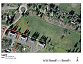 Parade Ground Close Up (6942531854).jpg 4,400 × 3,400; 11.1 MB
-
 Parade Ground Map (7088596445).jpg 4,400 × 3,400; 12.24 MB


.jpg)
.jpg)
.jpg)
.jpg)
.jpg)
.jpg)

.jpg)
.jpg)
.jpg)
.jpg)
.jpg)
.jpg)
.jpg)
.jpeg)
.jpg)
.jpg)