Category:Maps of Génos (Hautes-Pyrénées)
Wikimedia category | |||||
| Upload media | |||||
| Instance of | |||||
|---|---|---|---|---|---|
| Category combines topics | |||||
| Génos | |||||
commune in Hautes-Pyrénées, France  .svg)  | |||||
| Instance of | |||||
| Location |
| ||||
| Street address |
| ||||
| Population |
| ||||
| Area |
| ||||
| Elevation above sea level |
| ||||
| Different from | |||||
 | |||||
Subcategories
This category has the following 3 subcategories, out of 3 total.
Media in category "Maps of Génos (Hautes-Pyrénées)"
The following 8 files are in this category, out of 8 total.
-
 65 HP 13 4050.jpg 995 × 847; 314 KB
-
 65195-Génos - Localisation.png 2,000 × 2,480; 1.03 MB
-
 65195-Génos-argile.jpg 3,057 × 2,480; 768 KB
-
 65195-Génos-Cadastre.png 7,015 × 4,960; 6.91 MB
-
 65195-Génos-Hydro.png 7,015 × 4,960; 4.57 MB
-
 65195-Génos-Orthophoto.png 7,015 × 4,960; 31.21 MB
-
 65195-Génos-Sols.png 7,015 × 4,960; 4.87 MB
-
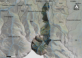
 Map commune FR insee code 65195.png 756 × 605; 62 KB


