Category:Maps of Görlitz
Wikimedia category | |||||
| Upload media | |||||
| Instance of | |||||
|---|---|---|---|---|---|
| Category combines topics | |||||
| Görlitz | |||||
town in Saxony, Germany      | |||||
| Pronunciation audio | |||||
| Instance of |
| ||||
| Location |
| ||||
| Located in or next to body of water | |||||
| Visitor center | |||||
| Head of government |
| ||||
| Population |
| ||||
| Area |
| ||||
| Elevation above sea level |
| ||||
| Different from | |||||
| official website | |||||
 | |||||
Subcategories
This category has the following 3 subcategories, out of 3 total.
O
P
Media in category "Maps of Görlitz"
The following 24 files are in this category, out of 24 total.
-
 Kreis Görlitz Stadt.PNG 1,500 × 2,036; 151 KB
-
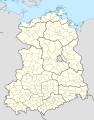 Görlitz in German Democratic Republic.svg 618 × 789; 3 MB
-
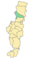
 Görlitz in GR.png 299 × 299; 29 KB
-
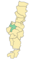
 Görlitz in GR.svg 1,908 × 1,938; 285 KB
-
 Görlitz map Altstadt.png 250 × 356; 2 KB
-
 Görlitz map Biesnitz.png 250 × 356; 2 KB
-
 Görlitz map Deutsch Ossig.png 250 × 356; 2 KB
-
 Görlitz map gesamt neu.png 285 × 357; 7 KB
-
 Görlitz map Hagenwerder.png 250 × 356; 2 KB
-
 Görlitz map Innenstadt.png 250 × 356; 2 KB
-
 Görlitz map Klein Neundorf.png 250 × 356; 2 KB
-
 Görlitz map Klingewalde.png 250 × 356; 2 KB
-
 Görlitz map Kunnerwitz.png 250 × 356; 2 KB
-
 Görlitz map königshufen.png 250 × 356; 2 KB
-
 Görlitz map Ludwigsdorf.png 250 × 356; 2 KB
-
 Görlitz map Nikolaivorstadt.png 250 × 356; 2 KB
-
 Görlitz map Ober-Neundorf.png 250 × 356; 2 KB
-
 Görlitz map Rauschwalde.png 250 × 356; 2 KB
-
 Görlitz map Schlauroth.png 250 × 356; 2 KB
-
 Görlitz map Südstadt.png 250 × 356; 2 KB
-
 Görlitz map Tauchritz.png 250 × 356; 2 KB
-
 Görlitz map Weinhübel.png 250 × 356; 2 KB
-
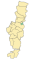
 Görlitz-Position.png 188 × 235; 3 KB
-
 Lage der kreisfreien Stadt Görlitz in Deutschland.png 188 × 235; 3 KB


