Category:Maps of Glacier National Park
United States national parks: Acadia · American Samoa · Arches · Badlands · Big Bend · Biscayne · Black Canyon of the Gunnison · Bryce Canyon · Canyonlands · Capitol Reef · Carlsbad Caverns · Channel Islands · Congaree · Crater Lake · Cuyahoga Valley · Death Valley · Denali · Dry Tortugas · Everglades · Gateway Arch · Gates of the Arctic · Glacier · Glacier Bay · Grand Canyon · Grand Teton · Great Basin · Great Smoky Mountains · Guadalupe Mountains · Haleakalā · Hawaii Volcanoes · Hot Springs · Indiana Dunes · Isle Royale · Joshua Tree · Kenai Fjords · Kings Canyon · Kobuk Valley · Lake Clark · Lassen Volcanic · Mammoth Cave · Mesa Verde · Mount Rainier · North Cascades · Olympic · Petrified Forest · Pinnacles · Redwood · Rocky Mountain · Saguaro · Sequoia · Shenandoah · Theodore Roosevelt · Virgin Islands · Voyageurs · White Sands · Wind Cave · Wrangell-St. Elias · Yellowstone · Yosemite · Zion
Wikimedia category | |||||
| Upload media | |||||
| Instance of | |||||
|---|---|---|---|---|---|
| Category combines topics | |||||
| Glacier National Park | |||||
national park in Flathead and Glacier counties in Montana, United States   | |||||
| Instance of | |||||
| Part of | |||||
| Location |
| ||||
| Visitor center | |||||
| Operator | |||||
| Has part(s) | |||||
| IUCN protected areas category | |||||
| Inception |
| ||||
| Highest point |
| ||||
| Area |
| ||||
| Elevation above sea level |
| ||||
| Visitors per year |
| ||||
| Different from | |||||
| official website | |||||
 | |||||
Subcategories
This category has the following 2 subcategories, out of 2 total.
Media in category "Maps of Glacier National Park"
The following 48 files are in this category, out of 48 total.
-
 Administrative map of Glacier National Park, Montana LOC 2016586564.jpg 9,788 × 8,492; 15.7 MB
-
 Administrative map of Glacier National Park, Montana LOC 2016586564.tif 9,788 × 8,492; 237.81 MB
-
 Blackfeet Indian Reservation map.PNG 553 × 382; 14 KB
-
 Glac gttsr map with structures.png 4,096 × 2,751; 926 KB
-
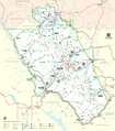
 Map of Glacier National Park.jpg 1,657 × 1,885; 1.96 MB
-
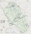
 GlacierParkMontanaNPSMap.PNG 1,971 × 2,107; 1.12 MB
-
 Going-to-the-Sun Road (Patterson).jpg 12,960 × 8,700; 21.01 MB
-
 Gtsr opening-map (7067857851).jpg 3,264 × 2,112; 2.82 MB
-
 LocMap Glacier National Park.png 280 × 183; 15 KB
-
 Logan Pass IPA Base Map (4545983483).jpg 1,100 × 850; 929 KB
-
 Map of Glacier National Park.PNG 1,657 × 1,885; 2.44 MB
-
 Map of Glacier National Park.png 3,250 × 3,406; 5.04 MB
-
 NPS glacier-apgar-campground-map.jpg 945 × 1,124; 155 KB
-
 NPS glacier-avalanche-campground-map.jpg 935 × 1,113; 138 KB
-
 NPS glacier-backcountry-campsite-map.gif 2,520 × 2,364; 458 KB
-
 NPS glacier-bowman-lake-campground-map.jpg 948 × 1,072; 206 KB
-
 NPS glacier-camping-map.gif 624 × 660; 26 KB
-
 NPS glacier-fish-creek-campground-map.jpg 1,275 × 1,650; 522 KB
-
 NPS glacier-goat-haunt-north-fork-trail-map.jpg 1,534 × 1,703; 384 KB
-
 NPS glacier-kintla-lake-campground-map.jpg 1,210 × 843; 106 KB
-
 NPS glacier-lake-mcdonald-map.gif 2,040 × 2,640; 344 KB
-
 NPS glacier-lake-mcdonald-map.pdf 1,275 × 1,650; 767 KB
-
 NPS glacier-lake-mcdonald-trail-map.jpg 788 × 2,110; 280 KB
-
 NPS glacier-main-trail-map.jpg 1,603 × 2,324; 596 KB
-
 NPS glacier-many-glacier-campground-map.jpg 2,200 × 1,700; 565 KB
-
 NPS glacier-many-glacier-map.gif 2,040 × 2,640; 323 KB
-
 NPS glacier-many-glacier-map.pdf 1,275 × 1,650; 348 KB
-
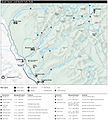
 NPS glacier-map.jpg 3,311 × 3,622; 2.06 MB
-
 NPS glacier-map.pdf 2,483 × 2,716; 4.23 MB
-
 NPS glacier-national-park-vegetation-map.jpg 5,928 × 7,512; 8.58 MB
-
 NPS glacier-quartz-creek-campground-map.jpg 947 × 1,081; 71 KB
-
 NPS glacier-rising-sun-campground-map.jpg 753 × 860; 84 KB
-
 NPS glacier-shuttle-map.jpg 688 × 429; 122 KB
-
 NPS glacier-sprague-creek-campground-map.jpg 949 × 1,046; 194 KB
-
 NPS glacier-st-mary-campground-map.jpg 764 × 756; 92 KB
-
 NPS glacier-st-mary-falls-trail-map.jpg 790 × 586; 63 KB
-
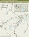
 NPS glacier-st-mary-map.gif 2,640 × 2,040; 360 KB
-
 NPS glacier-st-mary-map.pdf 1,650 × 1,275; 489 KB
-
 NPS glacier-trail-maps.pdf 3,412 × 2,550; 4.35 MB
-
 NPS glacier-two-medicine-campground-map.jpg 960 × 1,224; 192 KB
-
 NPS glacier-two-medicine-map.gif 2,700 × 2,100; 284 KB
-
 NPS glacier-two-medicine-map.pdf 1,687 × 1,312; 256 KB
-
 NPS glacier-two-medicine-trail-map.jpg 790 × 2,108; 245 KB
-
 NPS going-to-the-sun-road-map.jpg 4,896 × 3,156; 4.88 MB
-
 Pacific Northwest trail route overview.png 1,217 × 716; 410 KB
-
 Parque Nacional Glacier.JPG 290 × 189; 12 KB
-
 Photograph of "Map of the St. Mary's Lake Region, Montana." - NARA - 282364.jpg 1,880 × 3,000; 7.21 MB
-
 Photograph of "Map of the St. Mary's Lake Region, Montana." - NARA - 282364.tif 1,880 × 3,000; 16.14 MB


.jpg)
.jpg)

.jpg)


