Category:Maps of Hiroshima prefecture
日本語: 広島県の地図のカテゴリ。 日本全体における県の位置図は"Locator maps of ~"を、県内における各市町村の位置図は"Locator maps of municipalities ~"を、各郡の地図は"Maps of districts ~"を、過去の市町村の地図は"Maps of former municipalities ~"を参照。
Wikimedia category | |||||
| Upload media | |||||
| Instance of | |||||
|---|---|---|---|---|---|
| Category combines topics | |||||
| Hiroshima Prefecture | |||||
prefecture of Japan | |||||
| Instance of | |||||
| Named after | |||||
| Location | Japan | ||||
| Located in or next to body of water | |||||
| Capital | |||||
| Legislative body |
| ||||
| Executive body | |||||
| Head of government |
| ||||
| Legal form |
| ||||
| Highest point | |||||
| Population |
| ||||
| Area |
| ||||
| Replaces | |||||
| official website | |||||
 | |||||
Subcategories
This category has the following 9 subcategories, out of 9 total.
Pages in category "Maps of Hiroshima prefecture"
This category contains only the following page.
Media in category "Maps of Hiroshima prefecture"
The following 53 files are in this category, out of 53 total.
-
 Hiroshima-geo-stub.svg 657 × 595; 7 KB
-
-
 Culesi.png 1,200 × 800; 235 KB
-

-
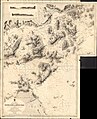
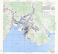
 FUKUYAMA Bombing Damage map 1945.jpg 5,285 × 3,741; 15.95 MB
-
 Fukuyama Castle 1644.jpg 5,287 × 4,548; 14.86 MB
-
 Hiroshima géolocalisation relief.svg 1,052 × 971; 4.29 MB
-
 Hiroshima géolocalisation.svg 1,052 × 971; 3.37 MB
-
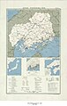
 Hiroshima map circa 1930.PNG 1,085 × 1,224; 1.01 MB
-
 Hiroshima Metropolitan Employment Area.svg 301 × 301; 69 KB
-
 Hiroshima pref.png 256 × 198; 11 KB
-
 Hiroshima wards.png 1,272 × 961; 155 KB
-
 Hiroshima Yamagata-gun.png 266 × 198; 12 KB
-
 Hiroshima-geo-stub.png 986 × 893; 48 KB
-
 Hiroshima-map.jpg 2,000 × 1,818; 715 KB
-
 HiroshimaMapCurrent.png 1,281 × 901; 44 KB
-
 HirosimakitaJCT Setumei.PNG 402 × 336; 6 KB
-
 HirosimakitaJCT Setumei2.PNG 402 × 336; 7 KB
-
 Itsukushima-island.png 166 × 139; 3 KB
-
 Japan - Hiroshima - Ken - DPLA - 455ba72cee893cf2e41bdce22781f98c.jpg 5,928 × 9,281; 5.7 MB
-
 Japan chugoku map small.png 235 × 300; 6 KB
-
 Japan Hiroshima Prefecture location map.svg 780 × 700; 27 KB
-
 Japan prov map aki.png 235 × 300; 6 KB
-
 Japan prov map bingo.png 235 × 300; 6 KB
-
 Jokamachi-Hiroshima-c-1710.jpg 320 × 439; 43 KB
-
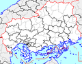
 JP Hiroshima Prefecture Regions.png 1,066 × 688; 36 KB
-
 Kure Bombing Damage map 1945.jpg 4,476 × 3,059; 10.53 MB
-
 Kure Topographic Maps 1954.jpg 1,718 × 1,360; 547 KB
-
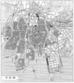
 Kure Urban planning 1924.jpg 3,825 × 3,232; 8.97 MB
-
 Map of BISAN Area , Hiroshima 1929.jpg 5,280 × 4,213; 14.7 MB
-
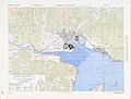
 Map of Hiro , kure 1945.jpg 5,000 × 4,614; 5.87 MB
-
 Map of Hiroshima Prefecture Ja.svg 534 × 489; 19 KB
-
 Map of Japan with highlight on 34 Hiroshima prefecture.svg 1,024 × 1,024; 15 KB
-
 Map of license plates in Hiroshima Japan.svg 780 × 700; 29 KB
-
 Mihara Banner.jpg 4,619 × 660; 1.61 MB
-
 MIHARA Castle Town 1644.jpg 5,286 × 4,500; 10.93 MB
-
 MIHARA Castle Town 1873.jpg 5,284 × 4,735; 3.9 MB
-
 MIHARA city map 1945.jpg 5,000 × 3,787; 4.74 MB
-
 OSM Norogawa Dam - Central Yasuura.png 600 × 338; 162 KB
-
 Road bridges in Hiroshima-Ehime.png 1,000 × 500; 144 KB
-
 Series L506, U.S. Army Map Service, 1953 (NI 53-5 Hiroshima).jpg 5,000 × 3,840; 5.62 MB
-
 Shadow picture of Hiroshima prefecture.png 463 × 395; 4 KB
-
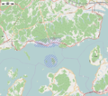 Tadanoumi Area 2015.png 959 × 850; 748 KB
-
 Waters off Tadanoumi map circa 1938.jpg 2,108 × 3,093; 344 KB
-
 地図 衆議院小選挙区 34 00.svg 534 × 489; 14 KB
-
 大崎上島位置図.png 1,000 × 720; 184 KB
-
 大崎下島位置図.png 1,000 × 720; 201 KB
-
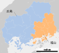
 広島5区地図.png 671 × 615; 73 KB
-
 府中町.png 256 × 198; 10 KB
-
 神機隊士の備中備後での戦歴.jpg 1,713 × 1,212; 253 KB
-
 福山市.png 256 × 198; 11 KB
-
 衆議院小選挙区 広島県2.svg 534 × 489; 31 KB
-
 豊島.png 900 × 500; 136 KB


_Oyster_parks_are.jpeg)
.jpg)