Category:Maps of Hobart, Tasmania
Subcategories
This category has only the following subcategory.
L
Media in category "Maps of Hobart, Tasmania"
The following 16 files are in this category, out of 16 total.
-

-
-
 A bird's-eye view of Hobart, Tasmania (15027182788).jpg 4,961 × 4,003; 5.06 MB
-
 Admiralty Chart No 2102 Tasmania, Derwent River, Published 1851.jpg 5,592 × 7,411; 7.81 MB
-
 Admiralty Chart No 3090 Pavilion Point to Dowsing Point, Published 1899, Large Corrections 1958.jpg 13,667 × 14,496; 66.74 MB
-

-

-
 Hobart locator-MJC.png 563 × 476; 12 KB
-
 Hobart Map.png 968 × 551; 18 KB
-
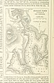
 Hobart Town Map (1838?) (15205244415).jpg 3,425 × 2,200; 1.68 MB
-
 Jarman's Map of Hobart Town 1858 (15018464719).jpg 2,149 × 3,425; 1.02 MB
-
 Jarman's Map of Hobart Town(1858).JPG 2,037 × 3,300; 1.51 MB
-
 Map and select directory of Hobart Town (15018467589).jpg 4,961 × 3,900; 3.37 MB
-
 Map of Hobart - Fire Underwriters' Association of Tasmania (15211319542).jpg 3,425 × 1,967; 931 KB
-

-
 Port Arthur and Hobart map (NationalMap) -- 1830s routes.png 1,544 × 1,368; 1.84 MB
.jpg)
%27_(11253438084).jpg)
.jpg)


_Edinburgh_(15190112526).jpg)


_(15205244415).jpg)
.jpg)
.JPG)
.jpg)
.jpg)
.jpg)
_--_1830s_routes.png)