Category:Maps of Ireland by Abraham Ortelius
There are several distinct map designs showing Ireland with a western-top orientation, which should not be confused:
- John Goghe (1560s)
- Category:Maps of Ireland by Abraham Ortelius (1570s-1580s)
- Category:Maps of Ireland facing West by Gerardus Mercator (1580s)
- Pieter van der Keere (1590s)
- Category:Maps of Ireland by Baptista Boazio (1600s)
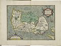
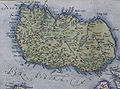
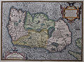
Media in category "Maps of Ireland by Abraham Ortelius"
The following 13 files are in this category, out of 13 total.
-
 Hibernia (NYPL b15404146-1632135).jpg 7,230 × 5,428; 6.28 MB
-
 A Modern Depiction of Ireland, One of the British Isles WDL104.png 1,315 × 1,024; 2.91 MB
-
 Atlas Ortelius KB PPN369376781-012av-012br.jpg 3,000 × 2,194; 4.62 MB
-
 Bodleian Libraries, Hiberniae Britannicae insvlae, nova descriptio.jpg 1,000 × 675; 174 KB
-
 Hiberniae Britannicae Insulae, Nova Descriptio, Eryn, Irlandt - btv1b53056777h.jpg 6,000 × 4,920; 5.23 MB
-
 Hiberniae, Britannicae Insvlae nova descripto. LOC 99466749.jpg 6,274 × 4,884; 6.81 MB
-
 Hiberniae, Britannicae Insvlae nova descripto. LOC 99466749.tif 6,274 × 4,884; 87.67 MB
-
 Map of Ireland 1 by Abraham Ortelius.jpeg 3,063 × 2,334; 2.32 MB
-
 Ortelius - Eryn, Britannicae Insulae 2.jpg 2,800 × 2,100; 1.9 MB
-
 Ortelius - Eryn, Britannicae Insulae.jpg 784 × 564; 128 KB
-
 Ortelius 1579 Ireland Map.jpg 568 × 423; 251 KB
-
 Ortelius 1592 Ireland Map.jpg 1,510 × 1,118; 814 KB
-
 UBBasel Map Irland 1575 Kartenslg Mappe 238-55.tif 10,111 × 6,867, 2 pages; 396.17 MB
.jpg)


