Category:Maps of Kham
Subcategories
This category has only the following subcategory.
Media in category "Maps of Kham"
The following 71 files are in this category, out of 71 total.
-
 'Front of Tibet' Map Painted by Wu Run-De (1907).jpg 1,000 × 827; 299 KB
-
 Der Jesuiten-Atlas der Kanghsi-Zeit - China und die Aussenlaender LOC 74650033-12.jpg 12,186 × 9,694; 12.61 MB
-
 Der Jesuiten-Atlas der Kanghsi-Zeit - China und die Aussenlaender LOC 74650033-12.tif 12,186 × 9,694; 337.98 MB
-
 Der Jesuiten-Atlas der Kanghsi-Zeit - China und die Aussenlaender LOC 74650033-17.jpg 7,498 × 9,654; 6.87 MB
-
 Der Jesuiten-Atlas der Kanghsi-Zeit - China und die Aussenlaender LOC 74650033-17.tif 7,498 × 9,654; 207.1 MB
-
 Der Jesuiten-Atlas der Kanghsi-Zeit - China und die Aussenlaender LOC 74650033-18.jpg 7,414 × 9,618; 6.83 MB
-
 Der Jesuiten-Atlas der Kanghsi-Zeit - China und die Aussenlaender LOC 74650033-18.tif 7,414 × 9,618; 204.01 MB
-

-
-
-

-

-

-

-

-

-
 Anville Nouvel atlas de la Chine - Page15 Chine generale couleur.jpg 2,500 × 1,755; 2.87 MB
-
 Anville Nouvel atlas de la Chine - Page87 - thibet bhoutan generale.jpg 5,112 × 4,048; 8.6 MB
-
 Anville Nouvel atlas de la Chine - Page97 - thibet 5e feuille si fan.jpg 2,816 × 4,336; 4.86 MB
-

-
 CEM-44-La-Chine-la-Tartarie-Chinoise-et-le-Thibet-1734-2568.jpg 2,552 × 1,832; 2.5 MB
-

-

-

-
 1837 Malte-Brun Map of China and Japan - Geographicus - China-mb-1837.jpg 2,328 × 1,758; 772 KB
-
 1912 China map from National Geographic.jpg 6,980 × 5,326; 10.65 MB
-
 1922 Map of India by Bartholomew in Imperial Gazetteer of India.jpg 3,729 × 3,449; 4.79 MB
-

-

-

-

-
 Brit IndianEmpireReligions3.jpg 1,534 × 1,241; 2.33 MB
-
 Buddhist sects.png 1,365 × 1,249; 236 KB
-

-
 China Proper Map William Mackenzie c1866.png 2,449 × 3,080; 15.13 MB
-
 China Proper.jpg 564 × 698; 160 KB
-
 Geographic locations of Qiangic and other East Asian populations.png 4,519 × 2,456; 1.41 MB
-
 Han Civilisation.png 880 × 650; 1 MB
-
 Han foreign relations CE 2.jpg 965 × 650; 558 KB
-
 Historic Tibet Map v češtině.png 970 × 608; 99 KB
-

-
-
 Map illustrating Edward Amundsen's journey in Sechuen, East Tibet and Yunnan.webp 1,025 × 1,600; 268 KB
-

-
 Map of Ming Chinese empire 1415 (cropped).jpg 1,440 × 2,178; 389 KB
-
 Map of Ming Chinese empire 1415.jpg 1,577 × 2,339; 451 KB
-
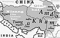
 Map of Tibet in 1798, from- Map China c1798 (cropped).jpg 348 × 255; 40 KB
-
 Map of Tibet in 1875 from China Proper map (cropped).jpg 182 × 365; 45 KB
-
 Map of Tibet in 1900, from- A map of China LOC 2007633876 (cropped).jpg 3,099 × 6,704; 3.69 MB
-

-
 Map of Tibet in 1909 (cropped).jpg 834 × 333; 416 KB
-
-

-

-
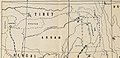
 Map of Tibet Ü-Tsang Amdo and Kham.jpg 295 × 187; 25 KB
-

-

-

-
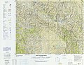 NH-47-3 Garze China.jpg 8,544 × 6,586; 8 MB
-
 Regni Sinae vel Sinae Propriae Mappa et Descriptio Geographica.jpg 6,416 × 7,071; 9.98 MB
-
 Salween River basin map.svg 317 × 518; 12.94 MB
-
 Simla Accord Treaty 1914 Map1.jpg 800 × 629; 151 KB
-
 Simla Convention - contending claims in Kham.jpg 1,725 × 1,397; 872 KB
-
 Simla Convention and ROC control in Kham.jpg 1,711 × 1,171; 745 KB
-
 Simla Convention borders in Kham.jpg 2,877 × 2,061; 1.38 MB
-
 Tibet ethnolinguistic 1967.png 668 × 386; 433 KB
-

-

-
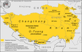
 Tibet provinces.png 1,421 × 986; 871 KB
-
 Tibetischer Kulturraum Karte 2.png 1,500 × 951; 454 KB
-
 Tibetischer Kulturraum Karte.png 1,500 × 951; 446 KB
.jpg)


.jpg)

.jpg)


_(14763682842).jpg)
.jpg)


_north_east.jpg)


.jpg)
_(14784338845).jpg)


.jpg)

.jpg)
.jpg)
.jpg)
_(14576990459)_(cropped).jpg)
_(cropped).jpg)
_about_the_year_1750_from_Regni_Sinae_vel_Sinae_Propriae_Mappa_et_Descriptio_Geographica_(cropped).jpg)
.png)

_(cropped).jpg)
.jpg)


.jpg)


.jpg)
_(cropped).jpg)