Category:Maps of Korea under Japanese rule
Media in category "Maps of Korea under Japanese rule"
The following 13 files are in this category, out of 13 total.
-
 Administrative Map of Chōsen (1913).svg 1,587 × 2,245; 1.57 MB
-
 Administrative Map of Chōsen (1914).svg 1,587 × 2,245; 1.4 MB
-
 Administrative Map of Chōsen (1917).svg 1,587 × 2,245; 2.79 MB
-
 Japanese Korea (orthographic projection).svg 600 × 600; 515 KB
-
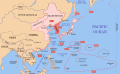
 Korea in Empire of Japan.svg 600 × 600; 644 KB
-
 Korea in japanese empire.png 1,000 × 1,000; 287 KB
-
 Korea map 1939-es.svg 634 × 387; 1.31 MB
-
 Korea map 1939-hu.svg 634 × 387; 2.2 MB
-
 Korea map 1939.svg 634 × 387; 2.23 MB
-
 Korea map in 1939.svg 634 × 387; 2.21 MB
-
 Map of Japan and Korea (1945), National Geographic.jpg 4,395 × 3,109; 2.97 MB
-
 National Geographic map of Korea and Japan, 1945.jpg 5,339 × 3,795; 6.58 MB
-
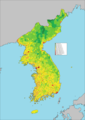 Population Density Map of Korea (December 31, 1944).png 2,000 × 2,835; 2.04 MB
.svg)
.svg)
.svg)
.svg)


,_National_Geographic.jpg)

.png)