Category:Maps of Lake Chad Drainage basin
Media in category "Maps of Lake Chad Drainage basin"
The following 23 files are in this category, out of 23 total.
-
 1911French Congo.png 1,348 × 1,360; 1.98 MB
-
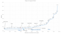
 Abfluss Megatschad.jpg 451 × 179; 31 KB
-
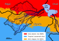
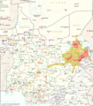 Boko Haram in Lake Chad Region.png 3,075 × 3,500; 5.45 MB
-
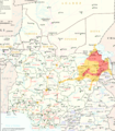
 Boko Haram in Lake Tchad Region.png 3,075 × 3,500; 4.47 MB
-
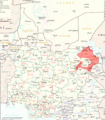
 Boko Haram Insurgency in Lake Chad Region (Feb. 11, 2015).png 3,075 × 3,500; 4.49 MB
-
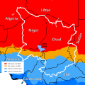 Chad Klima.svg 833 × 833; 371 KB
-
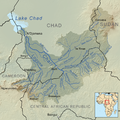
 Chad River Basin relief 2.png 2,212 × 2,131; 1.23 MB
-
 Chad River Basin relief.svg 531 × 511; 130 KB
-
 Charirivermap.png 1,001 × 1,000; 1.46 MB
-
 Eastern Sahel in Politische Wandkarte von Africa im Maßstabe by Heinrich Kiepert.jpg 4,669 × 2,399; 9.71 MB
-
 Lake Chad OSM.png 593 × 575; 298 KB
-
 Lake Chad region in 1890 - Bagirmi highlighted.svg 408 × 242; 316 KB
-

-
 NE Nigeria states and rivers.png 800 × 428; 97 KB
-
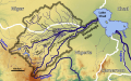
 OSM-LeChari.png 974 × 709; 356 KB
-
 Slope of Logone river.png 1,280 × 720; 88 KB
-
 Slope of Vina North.png 1,280 × 720; 74 KB
-
 Wadai region around 1890.svg 378 × 400; 484 KB
-
 Yobe Basin Koeppen.svg 567 × 390; 1.24 MB
-
 Yobe Basin OSM.svg 567 × 354; 2.76 MB
-
 Yobe river catchment area-es.svg 3,056 × 1,984; 542 KB
-
 Yobe river catchment area-pt.svg 3,056 × 1,984; 165 KB
-
 Yobe river catchment area.png 938 × 609; 66 KB


.png)


