Category:Maps of Lhasa
Media in category "Maps of Lhasa"
The following 130 files are in this category, out of 130 total.
-
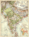 079 ostindien (1905).png 1,730 × 2,172; 2.28 MB
-
 Anville Nouvel atlas de la Chine - Page99 - thibet 6e feuille lasa.jpg 2,832 × 4,368; 4.15 MB
-
 (1882) MAP OF THE TRIBES OF INDIA.jpg 2,634 × 2,158; 1.57 MB
-
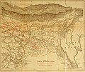
 1903 Routes between Tibet and India by O'Connor.jpg 6,340 × 4,888; 1.56 MB
-
-

-

-

-
 Administrative Division Lhasa.png 2,340 × 1,720; 304 KB
-
 Asia 13th Century.pdf 1,650 × 1,275; 3.57 MB
-
 Bangong-Nujiang Suture Zone.png 1,091 × 912; 130 KB
-
 Bichurin Lhassa.jpg 700 × 471; 243 KB
-
 Brit IndianEmpireReligions3.jpg 1,534 × 1,241; 2.33 MB
-
 British expedition to Tibet map.jpg 569 × 645; 63 KB
-

-
 Central Asian trade routes.jpg 954 × 674; 206 KB
-
 Chengguan District sketch map png.png 491 × 468; 59 KB
-
 Chengguan District sketch map.svg 491 × 468; 37 KB
-
 China topo.png 1,200 × 804; 1.35 MB
-
 China topo1.jpg 1,500 × 1,005; 1.26 MB
-
 Cho-Khang The Grand Temple of Buddha at Lhasa 1902.jpg 1,505 × 1,274; 483 KB
-
 D061- Tibet -liv2-ch11.png 1,454 × 1,896; 483 KB
-
 Dagze County sketch map png.png 910 × 1,130; 149 KB
-
 Dagze County sketch map.svg 910 × 1,130; 44 KB
-
 Damxung County sketch map png.png 296 × 308; 58 KB
-
 Damxung County sketch map.svg 300 × 306; 82 KB
-
 Doilungdêqên County png.png 257 × 370; 39 KB
-
 Doilungdêqên County sketch map.svg 256 × 369; 43 KB
-
 Doilungdêqên County.png 800 × 557; 134 KB
-
 Empire of King Nyimagon with three divisions about 975 .- 1000 CE.png 2,359 × 1,655; 794 KB
-
 Ethnolinguistic map of Tibet in 1983.png 528 × 790; 444 KB
-
 Evariste Huc carte voyage.jpg 3,559 × 2,794; 2.1 MB
-
 Historic Tibet Map-cs.svg 1,213 × 760; 508 KB
-

-
 India, distribution of languages, 1893.jpg 955 × 1,285; 216 KB
-
 Indian Railway network 1893.jpg 985 × 1,273; 242 KB
-
 IndiaPolitical1893ConstablesHandAtlas.jpg 1,318 × 1,027; 341 KB
-
 Lasa-map1.png 2,500 × 1,797; 747 KB
-
 Lasa.png 250 × 156; 52 KB
-
 Subdivisions of Lhasa-China.png 391 × 261; 4 KB
-
 Lhasa - Map of the Road to Lhasa Part 1.jpg 4,196 × 2,590; 1.43 MB
-
 Lhasa - Map of the Road to Lhasa Part 2.jpg 3,750 × 1,942; 704 KB
-
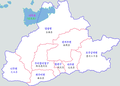
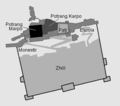
 Lhasa Counties.png 790 × 587; 45 KB
-
 Lhasa Lage.jpg 379 × 295; 34 KB
-

-
 Lhasa map.svg 1,520 × 1,059; 201 KB
-
 Lhasa mcp.png 487 × 318; 23 KB
-
 Lhasa municipality relief map png.png 592 × 425; 559 KB
-
 Lhasa municipality relief map.svg 592 × 425; 1.5 MB
-
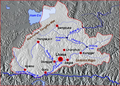
 Lhasa prefecture counties & communications png.png 324 × 214; 45 KB
-
 Lhasa prefecture counties & communications.svg 323 × 214; 91 KB
-
 Lhasa prefecture-level city.svg 600 × 428; 391 KB
-
 Lhasa terrane approach to Qiangtang terrane.svg 3,066 × 1,495; 24 KB
-
 Lhasa-map.png 800 × 593; 179 KB
-
 Lhasa.png 1,500 × 960; 314 KB
-
 Lhünzhub County sketch map png.png 370 × 266; 66 KB
-
 Lhünzhub County sketch map.svg 374 × 271; 89 KB
-

-
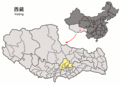
 Location of Chengguan within Xizang (China).png 880 × 620; 40 KB
-
 Location of Dagzê within Xizang (China).png 880 × 620; 40 KB
-
 Location of Damxung within Xizang (China).png 880 × 620; 40 KB
-
 Location of Doilungdêqên within Xizang (China).png 880 × 620; 40 KB
-
 Location of Lhasa districts within Xizang (China).png 880 × 620; 51 KB
-
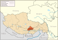
 Location of Lhasa within Xizang (China).png 880 × 620; 40 KB
-
 Location of Lhünzhub within Xizang (China).png 880 × 620; 40 KB
-
 Location of Maizhokunggar within Xizang (China).png 880 × 620; 40 KB
-
 Location of Nyêmo within Xizang (China).png 880 × 620; 40 KB
-
 Location of Qüxü within Xizang (China).png 880 × 620; 40 KB
-
 LocMap of WH Potala Palace ja.png 280 × 210; 31 KB
-
 LocMap of WH Potala Palace.png 280 × 210; 31 KB
-
 Maizhokunggar County Sketch Map png.png 2,051 × 1,745; 450 KB
-
 Maizhokunggar County Sketch Map.svg 2,050 × 1,744; 63 KB
-

-
 Map of Asia, Mitchell's School Atlas LOC 2007633727-13 (cropped).jpg 3,117 × 2,378; 1.79 MB
-

-
 Map of India (1882).jpg 1,652 × 2,177; 555 KB
-
 Map of Lhasa in 2015 detail, Stadtplan-Altstadt-Lhasa (cropped).JPG 3,108 × 2,274; 2.32 MB
-

-

-
 Map of Ming Chinese empire 1415 (cropped).jpg 1,440 × 2,178; 389 KB
-
 Map of Ming Chinese empire 1415-Tibet.jpg 742 × 507; 166 KB
-
 Map of Ming Chinese empire 1415.jpg 1,577 × 2,339; 451 KB
-

-
 Map of Tartary, Thibet, and China.png 2,951 × 2,262; 6.01 MB
-
 Map of the Four Horns of the Tibetan Empire (7th century)-EN.svg 3,264 × 1,179; 367 KB
-
 Map of the Four Horns of the Tibetan Empire (7th century)-es.svg 3,482 × 1,258; 500 KB
-

-
-
 Map of Tibet in 1798, from- Map China c1798 (cropped).jpg 348 × 255; 40 KB
-
 Map of Tibet in 1831 from Ost-Indien Mit Den Inseln (cropped).jpg 1,898 × 981; 851 KB
-
 Map of Tibet in 1855 from Vorder-Indien oder das Indo-Britische Reich (cropped).jpg 3,475 × 1,630; 2.64 MB
-

-

-

-
 Map of Tibet in 1905, from- 079 ostindien (1905) (cropped).png 1,166 × 702; 541 KB
-
 Map of Tibet in 1909 (cropped).jpg 834 × 333; 416 KB
-
 Map of Tibet in 1932 (cropped).jpg 2,676 × 1,687; 1.86 MB
-
 Map of Tibet Ü-Tsang Amdo and Kham.jpg 295 × 187; 25 KB
-
-

-

-
 McMahon Line Simla Accord Treaty 1914 Map1.jpg 3,595 × 2,640; 2.46 MB
-
 Ming China and Asia.jpg 250 × 332; 33 KB
-
 Ming Dynasty Administrative division.jpg 3,348 × 2,542; 447 KB
-
 Mitchell's school atlas LOC 2007633727-13.jpg 3,402 × 2,814; 1.97 MB
-
 Mitchell's school atlas LOC 2007633727-13.tif 3,402 × 2,814; 27.39 MB
-
 MtKailash location.png 980 × 615; 964 KB
-
 Nam Tso.png 719 × 606; 932 KB
-
 Nyêmo County sketch map png.png 292 × 353; 75 KB
-
 Nyêmo County sketch map.svg 300 × 357; 40 KB
-
 Ost-Indien Mit Den Inseln.jpg 5,304 × 4,331; 7.17 MB
-
 Pacific War - Southern Asia 1942 - Map.jpg 1,260 × 961; 183 KB
-
 Plán Lhasy.jpg 1,039 × 763; 222 KB
-
 Potala esquema.gif 600 × 531; 24 KB
-
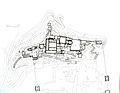 Potala Palace plan..jpg 2,051 × 1,592; 617 KB
-
 Quxu County sketch map png.png 1,739 × 1,093; 329 KB
-
 Quxu County sketch map.svg 1,738 × 1,093; 73 KB
-
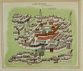
 Rolschildering van Lhasa en omgeving, anoniem, ca 1899, MAS.jpg 1,200 × 755; 457 KB
-
 Stadtplan-Altstadt-Lhasa.JPG 4,260 × 3,195; 4.11 MB
-
-
 The Empire of King Nyimagon with three divisions about 975 A. D.- 1000 A.D..jpg 1,726 × 1,189; 528 KB
-
 Tibet and Lhasa in 1899, Asia1899 (cropped).JPG 697 × 405; 182 KB
-
 Tibet ethnolinguistic 1967.png 668 × 386; 433 KB
-
 Tibetischer Kulturraum Karte 2.png 1,500 × 951; 454 KB
-
 Tibetischer Kulturraum Karte.png 1,500 × 951; 446 KB
-
 Txu-oclc-6654394-nh-46-2nd-ed.jpg 5,548 × 4,516; 6.29 MB
-

-
 Vorder-Indien oder das Indo-Britische Reich.jpg 5,683 × 4,568; 8.96 MB
-
 Voyage pittoresque en Asie et en Afrique (11874669205).jpg 2,011 × 1,264; 544 KB
-
 Yangtze River drainage basin map.svg 943 × 498; 9.6 MB
.png)

_MAP_OF_THE_TRIBES_OF_INDIA.jpg)

_(14580218849).jpg)
.jpg)


_north_east.jpg)


.jpg)


.jpg)


_(cropped).jpg)
.png)
.png)
.png)
.png)
.png)
.png)
.png)
.png)
.png)
.png)


_with_Lhasa_(Lassa)_capitol_and_India_(Hindoostan)_with_Calcutta_capitol_in_1839_from_Mitchell%27s_School_Atlas_LOC_2007633727-13_(cropped).jpg)
.jpg)
.jpg)
.jpg)
.JPG)
_and_the_Himalayas_in_1885_from_12_of_%27The_Imperial_Gazetteer_of_India_..._Second_edition_(revised_and_enlarged)%27_(11180098823)_(cropped).jpg)
.jpg)
.jpg)


.jpg)

_and_Lhasa_(Lassa)_in_1839,_Polar_projection,_from_Mitchell%27s_School_Atlas_LOC_2007633727-4_(cropped).jpg)
.jpg)
.jpg)
.jpg)
.jpg)
.jpg)
.png)
.jpg)
_(cropped).png)
.jpg)

.jpg)
_and_Lhasa_(Lassa)_in_1839,_equatorial_projection,_from_Mitchell%27s_School_Atlas_LOC_2007633727-4_(cropped).jpg)
.jpg)


_(14583136277).jpg)

.JPG)


.jpg)

-EN.svg)
-es.svg)
.jpg)