Category:Maps of Loire River in Indre-et-Loire
Subcategories
This category has the following 16 subcategories, out of 16 total.
M
- Maps of Berthenay (5 F)
- Maps of Bréhémont (5 F)
- Maps of Chouzé-sur-Loire (5 F)
- Maps of Coteaux-sur-Loire (8 F)
- Maps of La Chapelle-aux-Naux (5 F)
- Maps of La Riche (5 F)
- Maps of Montlouis-sur-Loire (7 F)
- Maps of Mosnes (5 F)
- Maps of Noizay (5 F)
- Maps of Pocé-sur-Cisse (5 F)
- Maps of Rigny-Ussé (5 F)
Media in category "Maps of Loire River in Indre-et-Loire"
The following 49 files are in this category, out of 49 total.
-
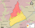
 37074-Chouzé-sur-Loire-argile.png 3,057 × 2,480; 3.01 MB
-
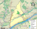
 37074-Chouzé-sur-Loire-Cours eau.jpg 3,507 × 2,480; 587 KB
-
 37074-Chouzé-sur-Loire-Sols.png 3,270 × 2,598; 2.65 MB
-
 37077-Cinq-Mars-la-Pile-argile.png 3,057 × 2,480; 3.29 MB
-
 37077-Cinq-Mars-la-Pile-Cours eau.jpg 3,507 × 2,480; 660 KB
-
 37077-Cinq-Mars-la-Pile-Sols.png 3,270 × 2,598; 2.77 MB
-
 37118-Huismes-argile.png 3,057 × 2,480; 3.21 MB
-
 37118-Huismes-Cours eau.jpg 3,507 × 2,480; 580 KB
-
 37118-Huismes-Sols.png 3,270 × 2,598; 2.71 MB
-
 37123-Langeais-argile.png 3,057 × 2,480; 4.16 MB
-
 37123-Langeais-Cours eau.jpg 3,507 × 2,480; 760 KB
-
 37123-Langeais-Sols.png 3,270 × 2,598; 2.86 MB
-
 37131-Limeray-argile.png 3,057 × 2,480; 3.22 MB
-
 37131-Limeray-Cours eau.jpg 3,507 × 2,480; 625 KB
-
 37131-Limeray-Sols.png 3,270 × 2,598; 2.67 MB
-
 37138-Lussault-sur-Loire-argile.png 3,057 × 2,480; 2.07 MB
-
 37138-Lussault-sur-Loire-Cours eau.jpg 3,507 × 2,480; 415 KB
-
 37138-Lussault-sur-Loire-Sols.png 3,270 × 2,598; 1.28 MB
-
 37156-Montlouis-sur-Loire-Cours eau.jpg 3,507 × 2,480; 670 KB
-
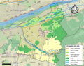
 37156-Montlouis-sur-Loire-Sols.png 3,270 × 2,598; 3.58 MB
-
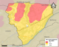
 37161-Mosnes-argile.png 3,057 × 2,480; 2.21 MB
-
 37161-Mosnes-Cours eau.jpg 3,507 × 2,480; 459 KB
-
 37161-Mosnes-Sols.png 3,270 × 2,598; 1.63 MB
-
 37163-Nazelles-Négron-argile.png 3,057 × 2,480; 3.41 MB
-
 37163-Nazelles-Négron-Cours eau.jpg 3,507 × 2,480; 666 KB
-
 37163-Nazelles-Négron-Sols.png 3,270 × 2,598; 3.07 MB
-
 37171-Noizay-argile.png 3,057 × 2,480; 2.61 MB
-
 37171-Noizay-Cours eau.jpg 3,507 × 2,480; 507 KB
-
 37171-Noizay-Sols.png 3,270 × 2,598; 1.88 MB
-
 37185-Pocé-sur-Cisse-argile.png 3,057 × 2,480; 2.92 MB
-
 37185-Pocé-sur-Cisse-Cours eau.jpg 3,507 × 2,480; 555 KB
-
 37185-Pocé-sur-Cisse-Sols.png 3,270 × 2,598; 2.51 MB
-
 Map commune FR insee code 37003.png 756 × 605; 76 KB
-
 Map commune FR insee code 37011.png 756 × 605; 51 KB
-
 Map commune FR insee code 37025.png 756 × 605; 63 KB
-
 Map commune FR insee code 37074.png 756 × 605; 69 KB
-
 Map commune FR insee code 37077.png 756 × 605; 64 KB
-
 Map commune FR insee code 37102.png 756 × 605; 29 KB
-
 Map commune FR insee code 37118.png 756 × 605; 72 KB
-
 Map commune FR insee code 37123.png 756 × 605; 93 KB
-
 Map commune FR insee code 37131.png 756 × 605; 76 KB
-
 Map commune FR insee code 37138.png 756 × 605; 38 KB
-
 Map commune FR insee code 37156.png 756 × 605; 88 KB
-
 Map commune FR insee code 37161.png 756 × 605; 53 KB
-
 Map commune FR insee code 37163.png 756 × 605; 74 KB
-
 Map commune FR insee code 37171.png 756 × 605; 57 KB
-
 Map commune FR insee code 37185.png 756 × 605; 65 KB
-
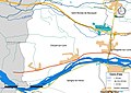
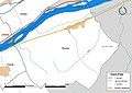
 Montlouis-sur-Loire OSM 01.png 1,540 × 820; 846 KB
-
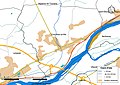
 Montlouis-sur-Loire OSM 02.png 1,540 × 820; 1.21 MB


