Category:Maps of Natchez, Mississippi
Subcategories
This category has only the following subcategory.
Media in category "Maps of Natchez, Mississippi"
The following 9 files are in this category, out of 9 total.
-
 Map of Natchez Harbor and Vicinity - NARA - 128215824.jpg 8,572 × 9,488; 3.79 MB
-

-
 Map Greater Natchez MS 1976 with Holy Family Catholic Church Historic District indicated.jpg 3,345 × 4,052; 3.25 MB
-
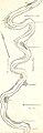
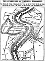 Map of Natchez, Mississippi, United States in May 1862.jpg 2,961 × 4,002; 2.32 MB
-
 Map of the roads leading to Natchez drawn for Brig. Gen. Wirt Adams. (10538975164).jpg 4,904 × 5,654; 2.69 MB
-
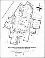 Mississippi SP Holy Family Catholic Church Historic District Natchez map.jpg 1,277 × 1,653; 280 KB
-
 MS Natchez and surrounding area map 1922.jpg 5,300 × 5,300; 2.65 MB
-
 Natchez Massacre location.png 1,025 × 1,627; 491 KB
-


.jpg)


.jpg)