Category:Maps of Nevers
Wikimedia category | |||||
| Upload media | |||||
| Instance of | |||||
|---|---|---|---|---|---|
| Category combines topics | |||||
| Nevers | |||||
commune in Nièvre, France    | |||||
| Instance of | |||||
| Location |
| ||||
| Located in or next to body of water | |||||
| Head of government |
| ||||
| Population |
| ||||
| Area |
| ||||
| Elevation above sea level |
| ||||
| official website | |||||
 | |||||
Subcategories
This category has the following 8 subcategories, out of 8 total.
A
- Attraction maps of Nevers (2 F)
H
- Hydrographic maps of Nevers (1 F)
O
- Old maps of Nevers (2 F)
U
- Urbanisation maps of Nevers (6 F)
Media in category "Maps of Nevers"
The following 8 files are in this category, out of 8 total.
-
 58 NIEVRE carte grille communale densite INSEE.png 3,507 × 2,480; 3.32 MB
-
 58194-Nevers-Hydro.jpeg 5,846 × 4,133; 3.25 MB
-
 58194-Nevers-Sols.png 3,270 × 2,598; 5.38 MB
-
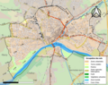
 Carte des quartiers de Nevers.svg 1,052 × 744; 25 KB
-
 Diocèse Nevers 1789.svg 2,000 × 1,922; 801 KB
-
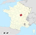
 Map commune FR insee code 58194.png 756 × 605; 55 KB
-
 Nevers OSM 01.png 1,129 × 826; 593 KB
-
 Nevers OSM 02.png 1,129 × 826; 975 KB


