Category:Maps of Old London (book)
Scans from Maps of Old London, ed. G. E. (Geraldine Edith) Mitton (1868-1955). London, Adam & Charles Black, 1908.
| Upload media | |||||
| Instance of | |||||
|---|---|---|---|---|---|
| |||||
Media in category "Maps of Old London (book)"
The following 12 files are in this category, out of 12 total.
-
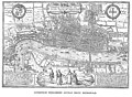 London Hoefnagel's Map of 1572.jpg 2,580 × 1,899; 1.95 MB
-
 Maps Of Old London Agas London.jpg 3,717 × 1,601; 1.44 MB
-
 Maps Of Old London Agas St Giles.jpg 2,073 × 1,599; 678 KB
-
 Maps Of Old London Faithorne.jpg 2,641 × 2,182; 1.25 MB
-
 Maps Of Old London Hoefnagel.jpg 2,602 × 1,901; 1.17 MB
-
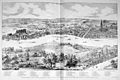
 Maps Of Old London Norden London.jpg 2,965 × 2,249; 1.43 MB
-
 Maps Of Old London Norden Westminster.jpg 2,930 × 2,049; 1.18 MB
-
 Maps Of Old London Ogilby.jpg 3,617 × 2,236; 1.53 MB
-
 Maps Of Old London Rocque.jpg 3,002 × 2,030; 1.55 MB
-
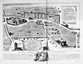
 Maps Of Old London Wyngaerde Part 1.jpg 2,553 × 1,711; 875 KB
-
 Maps Of Old London Wyngaerde Part 2.jpg 2,629 × 1,643; 933 KB
-
 Maps Of Old London Wyngaerde Part 3.jpg 2,577 × 1,687; 850 KB


