Category:Maps of Paris 16e arrondissement
|
Paris 1 • 2 • 3 • 4 • 5 • 6 • 7 • 8 • 9 • 10 • 11 • 12 • 13 • 14 • 15 • 16 • 17 • 18 • 19 • 20 |
Wikimedia category | |||||
| Upload media | |||||
| Instance of | |||||
|---|---|---|---|---|---|
| Category combines topics | |||||
| 16th arrondissement of Paris | |||||
one of the 20 administrative districts of Paris, France       | |||||
| Instance of |
| ||||
| Location | Paris, Grand Paris, Île-de-France, Metropolitan France, France | ||||
| Located in or next to body of water | |||||
| Head of government |
| ||||
| Inception |
| ||||
| Population |
| ||||
| Area |
| ||||
| Replaces | |||||
| official website | |||||
 | |||||
Subcategories
This category has the following 6 subcategories, out of 6 total.
M
- Maps of Stade Roland-Garros (9 F)
- Maps of the Bois de Boulogne (41 F)
Media in category "Maps of Paris 16e arrondissement"
The following 15 files are in this category, out of 15 total.
-
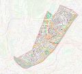
 16th arrondissement of Paris & the Villa Montmorency - OSM 2020.svg 512 × 470; 5.72 MB
-
 16th arrondissement of Paris - OSM 2020.svg 1,789 × 1,643; 5.62 MB
-
 Auteuil limites communales 1859 partage.svg 1,460 × 1,320; 14.17 MB
-
 Auteuil limites communales.svg 1,460 × 1,320; 14.13 MB
-
 Map commune FR insee code 75116.png 756 × 605; 140 KB
-
 Map of the 16th arrondissement of Paris - OSM 2020.svg 1,789 × 1,643; 5.69 MB
-
 Monumental 17.03.01 screenshot – map page.png 1,456 × 863; 923 KB
-
 Paris 16e arr jms.gif 850 × 700; 235 KB
-
 Paris 16e arrondissement - Eugène Andriveau-Goujon.jpg 5,412 × 4,032; 7.25 MB
-
 Paris 16th arrondissement map with listings - wts.svg 346 × 301; 9.47 MB
-
 Paris 16th arrondissement map with listings 2.png 3,460 × 3,008; 1.66 MB
-
 Paris 16th arrondissement map with listings.png 3,460 × 3,008; 1.01 MB
-
 Planche IGC carrière rue de Bassano.JPG 808 × 552; 134 KB
-
 Plans des lots cédés en 1928 par la Mairie de Paris.jpg 1,789 × 1,268; 595 KB
-
 Projets Auteuil Molitor.svg 436 × 332; 202 KB


