Category:Maps of Paris in the 1650s
Subcategories
This category has the following 4 subcategories, out of 4 total.
Media in category "Maps of Paris in the 1650s"
The following 8 files are in this category, out of 8 total.
-
 1652 Plan de Gomboust.jpg 5,177 × 4,708; 11.88 MB
-
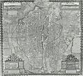
 Carte Paris Zeiller 13694.jpg 3,218 × 2,738; 9.52 MB
-

-
 Plan de la ville citté et vniversité et favxbovrgs de Paris, 1657 - Gallica.jpg 6,440 × 4,975; 18.46 MB
-
 Plan de Paris 1657.jpg 3,342 × 2,586; 10.13 MB
-
 Plan de la ville cite et vinversite et f. Paris 9108.jpg 3,900 × 3,005; 5.89 MB
-
 Plan de la Bataille de St. Antoine Donnée le 5 Juillet 1652 - Stanford Libraries.jpg 9,014 × 6,429; 19.13 MB
-
 Plan de la ville, citté et université et fauxbourgs de Paris... 1650 - Gallica.jpg 8,832 × 7,025; 12.36 MB


