Category:Maps of Rabat
Media in category "Maps of Rabat"
The following 15 files are in this category, out of 15 total.
-
 Carte maroc.png 650 × 761; 58 KB
-
 Circo rabat chellah.jpg 424 × 537; 59 KB
-
 Circo rabat ocean.jpg 424 × 536; 59 KB
-
 Circonscription Rabat-Chellah.svg 1,999 × 2,525; 77 KB
-
 Circonscription Rabat-Océan.svg 1,999 × 2,525; 77 KB
-
 Murailles Oudayas.png 524 × 496; 30 KB
-

-
 Rabat - Redistribution d'un quartier d'habitation de plaisance - Secteur Bou-Regreg - btv1b550132803.jpg 14,702 × 17,112; 34.12 MB
-
 Rabat OSM map.png 910 × 677; 500 KB
-
 Rabat-Fès. Cartes des étapes - btv1b53146718f.jpg 7,018 × 4,960; 3.62 MB
-
 Rabat-Fès. Cartes des étapes - btv1b84455525.jpg 9,274 × 6,450; 5.15 MB
-
 Rabat. Salé - btv1b84463054.jpg 4,654 × 5,796; 3.6 MB
-
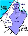
 RabatDistrict.jpg 942 × 1,280; 677 KB
-
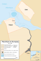 République du Bouregreg, Republic of Bouregreg, 1627-1668.PNG 904 × 1,340; 112 KB
-
 خريطة الرباط سلا 1942.jpg 4,378 × 5,966; 7.76 MB


