Category:Maps of Raja Ampat Regency
Media in category "Maps of Raja Ampat Regency"
The following 32 files are in this category, out of 32 total.
-
 92.05.00 PapuaBarat Raja Ampat.svg 201 × 169; 862 KB
-
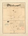 Admiralty Chart No 913 Harbours of Offak and Piapis on Waygiou, Published 1781.jpg 3,152 × 4,088; 2.58 MB
-
 Admiralty Chart No 914 Rawak Harbour on the north side of Waygiou, Published 1781.jpg 3,056 × 4,032; 2.6 MB
-

-
 Asia Islands (Raja Ampat) locator map.svg 514 × 701; 651 KB
-
 Batang Pele locator map.svg 543 × 701; 589 KB
-
 Batanta locator map.svg 543 × 701; 589 KB
-
 Forrest Chart of Kanary islands North of Mysol, Published 1781.jpg 3,120 × 4,000; 2.38 MB
-
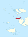
 Gag locator map.svg 543 × 701; 589 KB
-
 ID Asia.PNG 670 × 561; 20 KB
-
 ID Boo.PNG 670 × 561; 20 KB
-
 ID Fam.PNG 670 × 561; 20 KB
-
 ID Gag.png 670 × 561; 20 KB
-
 ID Kofiau.PNG 670 × 561; 20 KB
-
 ID Misool.PNG 670 × 561; 20 KB
-
 ID Raja Ampat.PNG 670 × 561; 20 KB
-
 ID Salawati.PNG 670 × 561; 20 KB
-
 ID Waigeo.PNG 670 × 561; 20 KB
-
 Jar (Raja Ampat) locator map.svg 543 × 701; 589 KB
-
 Kabra Island map.svg 1,514 × 1,489; 3.08 MB
-
 Karta ID RajaAmpat Isl.PNG 450 × 600; 19 KB
-
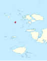
 Kawe locator map.svg 543 × 701; 589 KB
-
 Kofiau locator map.svg 543 × 701; 589 KB
-
 Mansuar locator map.svg 543 × 701; 589 KB
-
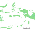
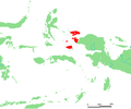
 Misool locator map.svg 543 × 701; 589 KB
-
 Pulau Raja locator map.svg 543 × 701; 589 KB
-
 Raja Ampat locator map (blank).svg 543 × 701; 553 KB
-
 Raja Ampat locator map (blank, with Asia Islands).svg 514 × 701; 614 KB
-
 Sajang locator map.svg 514 × 701; 650 KB
-
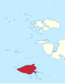
 Salawati locator map.svg 543 × 701; 589 KB
-
 Warir Island map.svg 1,689 × 1,851; 4.65 MB
-
 Weeim locator map.svg 543 × 701; 589 KB


_locator_map.svg)


_locator_map.svg)


.svg)
.svg)