Category:Maps of Rodrigues Island
Media in category "Maps of Rodrigues Island"
The following 33 files are in this category, out of 33 total.
-
-

-
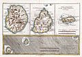
 Admiralty Chart No 715 Rodriguez Island, Published 1876.jpg 8,218 × 11,219; 16.43 MB
-
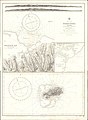
 Atoll research bulletin (1994) (20160366199).jpg 3,056 × 1,940; 1.32 MB
-
 Carte de Maurice.jpg 1,000 × 1,206; 230 KB
-
 Ile Rodrigue - btv1b53105398n.jpg 4,219 × 4,837; 1.87 MB
-
 Ile Rodrigues - btv1b530648478.jpg 6,530 × 9,206; 7.44 MB
-
 Ile Rodrigues - btv1b53105393d.jpg 3,748 × 2,815; 1.15 MB
-
 LocationRodrigues.PNG 248 × 117; 2 KB
-
 Map of Mauritius mk.svg 1,049 × 1,130; 1.43 MB
-
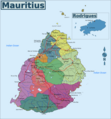 Map of Mauritius.png 2,332 × 2,510; 1.23 MB
-
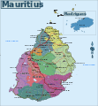 Map of Mauritius.svg 1,049 × 1,130; 1.43 MB
-
 Map tortue.jpg 463 × 293; 25 KB
-
 Mauritius rel90.jpg 1,000 × 1,206; 236 KB
-
 Rigobert-Bonne-Atlas-de-toutes-les-parties-connues-du-globe-terrestre MG 0002.tif 5,124 × 3,486; 51.14 MB
-
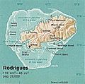 Rodrigues 76.jpg 409 × 405; 151 KB
-
 Rodrigues Island bathymetric environment map-fr.svg 1,776 × 1,173; 1.02 MB
-
 Rodrigues Island bathymetric environment map-mk.svg 1,776 × 1,173; 1.02 MB
-
 Rodrigues Island location map.svg 1,700 × 1,600; 81 KB
-
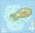
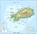
 Rodrigues Island relief map.svg 1,700 × 1,600; 697 KB
-
 Rodrigues Island topographic map-be.svg 1,700 × 1,600; 971 KB
-
 Rodrigues Island topographic map-de.png 1,700 × 1,600; 780 KB
-
 Rodrigues Island topographic map-de.svg 1,700 × 1,600; 750 KB
-
 Rodrigues Island topographic map-fr.png 1,700 × 1,600; 874 KB
-
 Rodrigues Island topographic map-fr.svg 1,700 × 1,600; 1,001 KB
-
 Rodrigues Island topographic map-rus.svg 1,700 × 1,600; 1,016 KB
-
 Rodrigues Island topographic-zones map-fr.svg 1,700 × 1,600; 989 KB
-
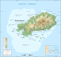
 Rodrigues locations named.svg 664 × 436; 169 KB
-
 Rodrigues Strassenkarte de.png 1,700 × 1,600; 836 KB
-
 Rodrigues Zonenkarte de.png 1,284 × 1,209; 559 KB
-
 Rodrigues.jpg 3,162 × 2,283; 5.87 MB
-
 Rodriquez Island.jpg 698 × 629; 189 KB
-
 Î. Rodrigues - btv1b531053993.jpg 3,536 × 2,679; 1.06 MB

.jpg)

_(20160366199).jpg)


