Category:Maps of Rogue River-Siskiyou National Forest
Subcategories
This category has the following 2 subcategories, out of 2 total.
Media in category "Maps of Rogue River-Siskiyou National Forest"
The following 12 files are in this category, out of 12 total.
-
 Roguerivermap.png 954 × 623; 1.09 MB
-
 Rogue river access map.png 958 × 1,923; 577 KB
-
 Butte Falls Ranger District map.jpg 171 × 136; 9 KB
-
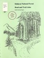 Siskiyou National Forest, road and trail atlas - Pacific Northwest Region (IA CAT10702708).pdf 1,216 × 1,606, 76 pages; 18.48 MB
-
 Chetco River Watershed.png 1,500 × 1,000; 1.8 MB
-
 Lookout air raid schema.jpg 588 × 580; 70 KB
-

-
 Rand Ranger Station Site Map.jpg 6,227 × 3,340; 807 KB
-
 Regeneration outlook on BLM lands in the Siskiyou Mountains (1986) (20385960428).jpg 2,906 × 2,502; 1.18 MB
-
 Rogue River Watershed.png 1,459 × 809; 1.45 MB
-
 Rogue River-Siskiyou National Forest map.pdf 2,550 × 1,650; 30.35 MB
-
 Wpdms shdrlfi020l chetco river.jpg 300 × 180; 34 KB


_(20385960428).jpg)

