Category:Maps of Roxbury, Boston
Media in category "Maps of Roxbury, Boston"
The following 124 files are in this category, out of 124 total.
-

-
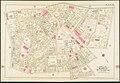
 1839 map Boston Deaborn 2674434011.jpg 1,901 × 2,000; 3.89 MB
-
 2012 District 7 Boston City Council electoral districts map.jpg 607 × 698; 563 KB
-

-

-

-
 Annual report of the Boston Water Board, for the year ending (1886) (14592609548).jpg 3,098 × 1,342; 645 KB
-
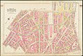
 Atlas of the city of Boston - city proper and Roxbury - plate 1 (19242153454).jpg 2,000 × 1,363; 3.19 MB
-
 Atlas of the city of Boston - city proper and Roxbury - plate 10 (19242156544).jpg 2,000 × 1,362; 3.05 MB
-
 Atlas of the city of Boston - city proper and Roxbury - plate 11 (19869774331).jpg 2,000 × 1,361; 2.01 MB
-
 Atlas of the city of Boston - city proper and Roxbury - plate 12 (19678210059).jpg 2,000 × 1,361; 2.81 MB
-
 Atlas of the city of Boston - city proper and Roxbury - plate 13 (19678210399).jpg 2,000 × 1,358; 2.73 MB
-
 Atlas of the city of Boston - city proper and Roxbury - plate 14 (19864823305).jpg 2,000 × 1,368; 2.55 MB
-
 Atlas of the city of Boston - city proper and Roxbury - plate 15 (19678211119).jpg 2,000 × 1,359; 3.03 MB
-
 Atlas of the city of Boston - city proper and Roxbury - plate 16 (19243907213).jpg 2,000 × 1,366; 3.07 MB
-
 Atlas of the city of Boston - city proper and Roxbury - plate 17 (19857403272).jpg 2,000 × 1,356; 2.94 MB
-
 Atlas of the city of Boston - city proper and Roxbury - plate 18 (19243907723).jpg 2,000 × 1,353; 2.81 MB
-
 Atlas of the city of Boston - city proper and Roxbury - plate 19 (19242159234).jpg 2,000 × 1,356; 2.94 MB
-
 Atlas of the city of Boston - city proper and Roxbury - plate 2 (19243902633).jpg 2,000 × 1,358; 3.09 MB
-
 Atlas of the city of Boston - city proper and Roxbury - plate 20 (19676789158).jpg 2,000 × 1,361; 2.97 MB
-
 Atlas of the city of Boston - city proper and Roxbury - plate 21 (19678213059).jpg 2,000 × 1,361; 2.66 MB
-
 Atlas of the city of Boston - city proper and Roxbury - plate 22 (19678213759).jpg 2,000 × 1,358; 2.29 MB
-
 Atlas of the city of Boston - city proper and Roxbury - plate 23 (19676810310).jpg 2,000 × 1,364; 3.1 MB
-
 Atlas of the city of Boston - city proper and Roxbury - plate 24 (19857406412).jpg 2,000 × 1,360; 3.01 MB
-
 Atlas of the city of Boston - city proper and Roxbury - plate 25 (19243911093).jpg 2,000 × 1,354; 3.07 MB
-
 Atlas of the city of Boston - city proper and Roxbury - plate 26 (19869780481).jpg 2,000 × 1,356; 2.78 MB
-
 Atlas of the city of Boston - city proper and Roxbury - plate 27 (19838609006).jpg 2,000 × 1,360; 2.91 MB
-
 Atlas of the city of Boston - city proper and Roxbury - plate 28 (19864828705).jpg 2,000 × 1,363; 2.95 MB
-
 Atlas of the city of Boston - city proper and Roxbury - plate 29 (19857408022).jpg 2,000 × 1,355; 2.47 MB
-
 Atlas of the city of Boston - city proper and Roxbury - plate 3 (19676783088).jpg 2,000 × 1,355; 2.87 MB
-
 Atlas of the city of Boston - city proper and Roxbury - plate 30 (19838610556).jpg 2,000 × 1,368; 2.98 MB
-
 Atlas of the city of Boston - city proper and Roxbury - plate 31 (19864835365).jpg 2,000 × 1,356; 2.81 MB
-
 Atlas of the city of Boston - city proper and Roxbury - plate 32 (19838616646).jpg 2,000 × 1,364; 2.51 MB
-
 Atlas of the city of Boston - city proper and Roxbury - plate 33 (19838617186).jpg 2,000 × 1,360; 2.68 MB
-
 Atlas of the city of Boston - city proper and Roxbury - plate 34 (19242170264).jpg 2,000 × 1,359; 2.77 MB
-
 Atlas of the city of Boston - city proper and Roxbury - plate 35 (19857415652).jpg 2,000 × 1,357; 2.76 MB
-
 Atlas of the city of Boston - city proper and Roxbury - plate 36 (19676801738).jpg 2,000 × 1,364; 2.53 MB
-
 Atlas of the city of Boston - city proper and Roxbury - plate 37 (19242171044).jpg 2,000 × 1,357; 2.42 MB
-
 Atlas of the city of Boston - city proper and Roxbury - plate 38 (19838618506).jpg 2,000 × 1,357; 2.42 MB
-
 Atlas of the city of Boston - city proper and Roxbury - plate 39 (19676802498).jpg 2,000 × 1,356; 2.26 MB
-
 Atlas of the city of Boston - city proper and Roxbury - plate 4 (19857398852).jpg 2,000 × 1,365; 3.17 MB
-
 Atlas of the city of Boston - city proper and Roxbury - plate 5 (19242154604).jpg 2,000 × 1,359; 3.08 MB
-
 Atlas of the city of Boston - city proper and Roxbury - plate 6 (19678208329).jpg 2,000 × 1,361; 3.32 MB
-
 Atlas of the city of Boston - city proper and Roxbury - plate 7 (19838601956).jpg 2,000 × 1,365; 3.09 MB
-
 Atlas of the city of Boston - city proper and Roxbury - plate 8 (19678208949).jpg 2,000 × 1,366; 2.84 MB
-
 Atlas of the city of Boston - city proper and Roxbury - plate 9 (19242156134).jpg 2,000 × 1,358; 2.89 MB
-

-

-

-
 Atlas of the city of Boston - Roxbury - (title page) (19851246442).jpg 1,484 × 2,000; 3.25 MB
-
 Atlas of the city of Boston - Roxbury - plate A (19858661055).jpg 2,000 × 1,340; 2.93 MB
-
 Atlas of the city of Boston - Roxbury - plate B (19832456476).jpg 2,000 × 1,359; 2.77 MB
-
 Atlas of the city of Boston - Roxbury - plate C (19832456876).jpg 2,000 × 1,362; 2.82 MB
-
 Atlas of the city of Boston - Roxbury - plate D (19858661575).jpg 2,000 × 1,365; 2.52 MB
-
 Atlas of the city of Boston - Roxbury - plate E (19672060469).jpg 2,000 × 1,366; 2.73 MB
-
 Atlas of the city of Boston - Roxbury - plate F (19670640680).jpg 2,000 × 1,361; 3.03 MB
-
 Atlas of the city of Boston - Roxbury - plate G (19832458006).jpg 2,000 × 1,363; 2.83 MB
-
 Atlas of the city of Boston - Roxbury - plate H (19863605911).jpg 2,000 × 1,358; 2.73 MB
-
 Atlas of the city of Boston - Roxbury - plate I (19237741673).jpg 2,000 × 1,359; 2.77 MB
-
 Atlas of the city of Boston - Roxbury - plate J (19672061909).jpg 2,000 × 1,357; 2.85 MB
-
 Atlas of the city of Boston - Roxbury - plate K (19237742343).jpg 2,000 × 1,357; 2.44 MB
-
 Atlas of the city of Boston - Roxbury - plate L (19832459506).jpg 2,000 × 1,355; 2.4 MB
-
 Atlas of the city of Boston - Roxbury - plate M (19670643090).jpg 2,000 × 1,359; 2.7 MB
-
 Atlas of the city of Boston - Roxbury - plate N (19670643360).jpg 2,000 × 1,360; 2.49 MB
-
 Atlas of the city of Boston - Roxbury - plate O (19670643630).jpg 2,000 × 1,361; 2.57 MB
-
 Atlas of the city of Boston - Roxbury - plate P (19672063379).jpg 2,000 × 1,363; 2.79 MB
-
 Atlas of the city of Boston - Roxbury - plate Q (19672063719).jpg 2,000 × 1,360; 2.48 MB
-
 Atlas of the city of Boston - Roxbury - plate R (19832460916).jpg 2,000 × 1,358; 2.21 MB
-
 Atlas of the city of Boston - Roxbury - plate S (19858665585).jpg 2,000 × 1,359; 2.47 MB
-
 Atlas of the city of Boston - Roxbury - plate T (19237744663).jpg 2,000 × 1,360; 2.54 MB
-
 Atlas of the city of Boston - Roxbury - plate U (19832461766).jpg 2,000 × 1,366; 2.42 MB
-
 Atlas of the city of Boston - South and East Boston - plate A (19236881734).jpg 2,000 × 1,372; 2.89 MB
-
 Atlas of the city of Boston, Boston proper and Roxbury - (title page) (19265078324).jpg 2,000 × 1,378; 2.33 MB
-
 Atlas of the city of Boston, Boston proper and Roxbury - plate 1 (19699722100).jpg 2,000 × 1,374; 3.16 MB
-
 Atlas of the city of Boston, Boston proper and Roxbury - plate 10 (19892738001).jpg 2,000 × 1,369; 2.95 MB
-
 Atlas of the city of Boston, Boston proper and Roxbury - plate 11 (19265082474).jpg 2,000 × 1,372; 2.85 MB
-
 Atlas of the city of Boston, Boston proper and Roxbury - plate 12 (19265082824).jpg 2,000 × 1,375; 3.04 MB
-
 Atlas of the city of Boston, Boston proper and Roxbury - plate 13 (19892738871).jpg 2,000 × 1,370; 3.06 MB
-
 Atlas of the city of Boston, Boston proper and Roxbury - plate 14 (19861505436).jpg 2,000 × 1,375; 3.16 MB
-
 Atlas of the city of Boston, Boston proper and Roxbury - plate 15 (19265084284).jpg 2,000 × 1,372; 2.93 MB
-
 Atlas of the city of Boston, Boston proper and Roxbury - plate 16 (19880262562).jpg 2,000 × 1,371; 2.97 MB
-
 Atlas of the city of Boston, Boston proper and Roxbury - plate 17 (19699708268).jpg 2,000 × 1,378; 2.92 MB
-
 Atlas of the city of Boston, Boston proper and Roxbury - plate 18 (19699728170).jpg 2,000 × 1,374; 3.02 MB
-
 Atlas of the city of Boston, Boston proper and Roxbury - plate 19 (19699728420).jpg 2,000 × 1,372; 2.94 MB
-
 Atlas of the city of Boston, Boston proper and Roxbury - plate 2 (19699722470).jpg 2,000 × 1,371; 3.08 MB
-
 Atlas of the city of Boston, Boston proper and Roxbury - plate 20 (19880263682).jpg 2,000 × 1,374; 2.8 MB
-
 Atlas of the city of Boston, Boston proper and Roxbury - plate 21 (19892742111).jpg 2,000 × 1,373; 3.01 MB
-
 Atlas of the city of Boston, Boston proper and Roxbury - plate 22 (19701075259).jpg 2,000 × 1,374; 2.81 MB
-
 Atlas of the city of Boston, Boston proper and Roxbury - plate 23 (19699710158).jpg 2,000 × 1,379; 2.42 MB
-
 Atlas of the city of Boston, Boston proper and Roxbury - plate 24 (19892743091).jpg 2,000 × 1,379; 2.42 MB
-
 Atlas of the city of Boston, Boston proper and Roxbury - plate 25 (19892743921).jpg 2,000 × 1,371; 2.39 MB
-
 Atlas of the city of Boston, Boston proper and Roxbury - plate 26 (19265088404).jpg 2,000 × 1,370; 2.49 MB
-
 Atlas of the city of Boston, Boston proper and Roxbury - plate 27 (19880266612).jpg 2,000 × 1,377; 2.33 MB
-
 Atlas of the city of Boston, Boston proper and Roxbury - plate 28 (19699731790).jpg 2,000 × 1,372; 2.32 MB
-
 Atlas of the city of Boston, Boston proper and Roxbury - plate 29 (19699732150).jpg 2,000 × 1,378; 2.32 MB
-
 Atlas of the city of Boston, Boston proper and Roxbury - plate 3 (19701068589).jpg 2,000 × 1,377; 3.02 MB
-
 Atlas of the city of Boston, Boston proper and Roxbury - plate 30 (19880267592).jpg 2,000 × 1,373; 2.35 MB
-
 Atlas of the city of Boston, Boston proper and Roxbury - plate 31 (19265090104).jpg 2,000 × 1,371; 2.35 MB
-
 Atlas of the city of Boston, Boston proper and Roxbury - plate 32 (19265090394).jpg 2,000 × 1,370; 2.75 MB
-
 Atlas of the city of Boston, Boston proper and Roxbury - plate 33 (19699733550).jpg 2,000 × 1,377; 2.45 MB
-
 Atlas of the city of Boston, Boston proper and Roxbury - plate 34 (19701079949).jpg 2,000 × 1,371; 2.47 MB
-
 Atlas of the city of Boston, Boston proper and Roxbury - plate 35 (19699734530).jpg 2,000 × 1,372; 2.84 MB
-
 Atlas of the city of Boston, Boston proper and Roxbury - plate 36 (19861514296).jpg 2,000 × 1,377; 2.66 MB
-
 Atlas of the city of Boston, Boston proper and Roxbury - plate 37 (19699715608).jpg 2,000 × 1,372; 2.59 MB
-
 Atlas of the city of Boston, Boston proper and Roxbury - plate 38 (19266812793).jpg 2,000 × 1,377; 2.91 MB
-
 Atlas of the city of Boston, Boston proper and Roxbury - plate 39 (19266813183).jpg 2,000 × 1,375; 2.35 MB
-
 Atlas of the city of Boston, Boston proper and Roxbury - plate 4 (19892736031).jpg 2,000 × 1,365; 2.78 MB
-
 Atlas of the city of Boston, Boston proper and Roxbury - plate 40 (19861515626).jpg 2,000 × 1,375; 2.78 MB
-
 Atlas of the city of Boston, Boston proper and Roxbury - plate 41 (19880271732).jpg 2,000 × 1,372; 2.88 MB
-
 Atlas of the city of Boston, Boston proper and Roxbury - plate 42 (19699717608).jpg 2,000 × 1,382; 2.71 MB
-
 Atlas of the city of Boston, Boston proper and Roxbury - plate 43 (19887755085).jpg 2,000 × 1,374; 2.61 MB
-
 Atlas of the city of Boston, Boston proper and Roxbury - plate 44 (19266815183).jpg 2,000 × 1,376; 2.12 MB
-
 Atlas of the city of Boston, Boston proper and Roxbury - plate 45 (19892751641).jpg 2,000 × 1,371; 2.31 MB
-
 Atlas of the city of Boston, Boston proper and Roxbury - plate 5 (19880258542).jpg 2,000 × 1,370; 3.14 MB
-
 Atlas of the city of Boston, Boston proper and Roxbury - plate 6 (19699723650).jpg 2,000 × 1,374; 3.06 MB
-
 Atlas of the city of Boston, Boston proper and Roxbury - plate 7 (19265080964).jpg 2,000 × 1,373; 3.11 MB
-
 Atlas of the city of Boston, Boston proper and Roxbury - plate 8 (19861503116).jpg 2,000 × 1,388; 2.71 MB
-
 Atlas of the city of Boston, Boston proper and Roxbury - plate 9 (19880260022).jpg 2,000 × 1,380; 2.69 MB
-
 March 1888 map and profile of old and new Stony Brook conduits.jpg 2,001 × 1,632; 693 KB
-
 Outline and index map of Boston proper and Roxbury (19242152234).jpg 2,000 × 1,363; 2.82 MB
-
 Outline and index map of Boston proper and Roxbury (19701067609).jpg 2,000 × 1,373; 2.88 MB
-
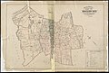 Outline and index map of Roxbury, city of Boston (19670639100).jpg 2,000 × 1,347; 2.53 MB
-
 Plan of land in Roxbury belonging to the heirs of Alfred Evans (2675079106).jpg 2,000 × 1,518; 2.14 MB
-


.jpg)
.jpg)
.jpg)
_(14592609548).jpg)
.jpg)
.jpg)
.jpg)
.jpg)
.jpg)
.jpg)
.jpg)
.jpg)
.jpg)
.jpg)
.jpg)
.jpg)
.jpg)
.jpg)
.jpg)
.jpg)
.jpg)
.jpg)
.jpg)
.jpg)
.jpg)
.jpg)
.jpg)
.jpg)
.jpg)
.jpg)
.jpg)
.jpg)
.jpg)
.jpg)
.jpg)
.jpg)
.jpg)
.jpg)
.jpg)
.jpg)
.jpg)
.jpg)
.jpg)
_(19838598106).jpg)
_(19857395882).jpg)
_(19861550015).jpg)
_(19851246442).jpg)
.jpg)
.jpg)
.jpg)
.jpg)
.jpg)
.jpg)
.jpg)
.jpg)
.jpg)
.jpg)
.jpg)
.jpg)
.jpg)
.jpg)
.jpg)
.jpg)
.jpg)
.jpg)
.jpg)
.jpg)
.jpg)
.jpg)
_(19265078324).jpg)
.jpg)
.jpg)
.jpg)
.jpg)
.jpg)
.jpg)
.jpg)
.jpg)
.jpg)
.jpg)
.jpg)
.jpg)
.jpg)
.jpg)
.jpg)
.jpg)
.jpg)
.jpg)
.jpg)
.jpg)
.jpg)
.jpg)
.jpg)
.jpg)
.jpg)
.jpg)
.jpg)
.jpg)
.jpg)
.jpg)
.jpg)
.jpg)
.jpg)
.jpg)
.jpg)
.jpg)
.jpg)
.jpg)
.jpg)
.jpg)
.jpg)
.jpg)
.jpg)
.jpg)
.jpg)

.jpg)
.jpg)
.jpg)
.jpg)
_(14781546184).jpg)