Category:Maps of Ségura
Wikimedia category | |||||
| Upload media | |||||
| Instance of | |||||
|---|---|---|---|---|---|
| Category combines topics | |||||
| Ségura | |||||
commune in Ariège, France  .svg) | |||||
| Instance of | |||||
| Location |
| ||||
| Population |
| ||||
| Area |
| ||||
| Elevation above sea level |
| ||||
 | |||||
Media in category "Maps of Ségura"
The following 6 files are in this category, out of 6 total.
-
 09284-Ségura-argile.png 4,076 × 3,307; 5.19 MB
-
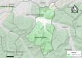
 09284-Ségura-Natura2000.png 5,846 × 4,133; 10.11 MB
-
 09284-Ségura-Natura2000b.png 5,846 × 4,133; 10.65 MB
-
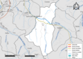 09284-Ségura-Routes-Hydro.png 3,507 × 2,480; 1.75 MB
-
 09284-Ségura-ZNIEFF1.png 3,519 × 2,480; 5.74 MB
-
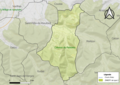 09284-Ségura-ZNIEFF2.png 3,519 × 2,480; 5.57 MB


