<nowiki>Category:Maps of Schwarzburg-Sondershausen; categoría de Wikimedia; kategori Wikimedia; Wikimedia category; د ويکيمېډيا وېشنيزه; Vikimedya kategorisi; ویکیمیڈیا زمرہ; kategória projektov Wikimedia; категорія проєкту Вікімедіа; 维基媒体分类; Wikimedia-Kategorie; kategorie na projektech Wikimedia; kategorija na Wikimediji; विकिपीडिया:श्रेणी; page de catégorie de Wikimedia; kategorija na Wikimediji; विकिपीडिया वर्ग; категорија на Викимедији; Wikimedia-Kategorie; Wikimedia-kategori; kategori Wikimédia; تصنيف ويكيميديا; pajenn rummata eus Wikimedia; Wikimedia:ကဏ္ဍခွဲခြင်း; 維基媒體分類; Wikimedia категориясы; categoría de Wikimedia; Wikimedia-categorie; Wikimedia-Kategorie; tudalen categori Wikimedia; kategori e Wikimedias; ردهٔ ویکیپدیا; 维基媒体分类; Wikimedia-kategory; ვიკიპედია:კატეგორიზაცია; ウィキメディアのカテゴリ; categoria Wikimedia; تصنيف بتاع ويكيميديا; විකිමීඩියා ප්රභේද පිටුව; categoria Vicimediorum; विकिमीडिया श्रेणी; Wikimedia-luokka; Wikimedia-categorie; guruhi Vikimedia; катэгорыя ў праекце Вікімэдыя; Викимедиа проектындагы төркем; catigurìa di nu pruggettu Wikimedia; หน้าหมวดหมู่วิกิมีเดีย; Wikimedia:Kategorija; Wikimedia-Kategorie; Wikimedia:Klassys; категория на Уикимедия; categorie a unui proiect Wikimedia; categurìa 'e nu pruggette Wikimedia; Wikimedia-kategori; kawan Wikimèdia; гурӯҳи Викимедиа; 위키미디어 분류; Wikimedia-bólkur; kategorio en Vikimedio; kategori Wikimedia; Wikimedia:Ronnaghys; উইকিমিডিয়া বিষয়শ্রেণী; kategori Wikimedia; 维基媒体分类; וויקימעדיע קאַטעגאָריע; kategorija w projektach Wikimedije; thể loại Wikimedia; Wikimedia projekta kategorija; Wikimedia-kategorie; categoria de um projeto da Wikimedia; 维基媒体分类; категорияд Ангилал; Wikimedia-kategori; kategori Wikimedia; پۆلی ویکیمیدیا; Wikimedia category; Vikimédia ñemohenda; Wikimédia-kategória; વિકિપીડિયા શ્રેણી; Wikimediako kategoria; категория в проекте Викимедиа; Wikimedia-Kategorie; Kategoriya ning Wikimedia; Wikimedia-kategorie; Wîkîmediya:Kategorî; विकिमिडिया श्रेणी; Wikimedia-Kategorie; קטגוריה במיזמי ויקימדיה; Викимедиа проектындагы төркем; κατηγορία εγχειρημάτων Wikimedia; विकिमिडिया श्रेणी; Wikimedia-Kategorie; Wikimedia-kategoriija; гурӯҳи Викимедиа; Wikimedia-categorie; categoría de Wikimedia; Wikimedia category; categoria di un progetto Wikimedia; Vikipidiya:Shopni; jamii ya Wikimedia; categoria de Wikimedia; Wikimedia kategooria; 維基媒體分類; Վիքիմեդիայի նախագծի կատեգորիա; Wikimedia proyektındağı törkem; 維基媒體分類; ẹ̀ka Wikimedia; Викимедиина категорија; categoria de um projeto da Wikimedia; Wikimedia-Kategorie; Wikimedia-kategori; tumbung Wikimedia; kategoria ti Wikimedia; kategorija Wikimedie; kategorya ng Wikimedia; Viciméid catagóir; Wikimedia category; kategori Wikimedia; kategoria w projekcie Wikimedia; വിക്കിമീഡിയ വർഗ്ഗം; 維基媒體分類; kategori Wikimedia; катэгорыя ў праекце Вікімедыя; زمرو:وڪيپيڊيا زمرا بندي; Викимедиа категорияһы; categoría de Wikimedia; 維基媒體分類; 维基媒体分类; விக்கிமீடியப் பகுப்பு</nowiki>


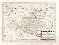 Reilly 380.jpg 1,665 × 1,282; 495 KB
 Carte des Etats de Thuringe - Duché de Saxe-Cobourg et Gotha - 1893.jpg 5,539 × 3,910; 7.34 MB
 Deutsches Reich (Karte) Schwarzburg-Sondershausen.svg 650 × 545; 1.04 MB
 Karte Schwarzburger Fürstentümer.jpg 445 × 395; 127 KB
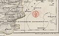 Kreis Worbis 1840 (19).jpg 3,077 × 1,929; 2.04 MB
 Map of Schwarzburg in 1574.svg 964 × 1,584; 962 KB
 Map of Schwarzburg in 1584.svg 964 × 1,584; 958 KB
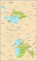 Map of Schwarzburg in 1599.svg 964 × 1,584; 945 KB
 Map of Schwarzburg in 1651.svg 964 × 1,584; 965 KB
 Map of Schwarzburg in 1682.svg 964 × 1,584; 969 KB
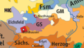 North Thuringia and Harz 1648.png 600 × 346; 85 KB
 Regierungsbezirk Erfurt 2.png 546 × 417; 609 KB
 Regierungsbezirk Erfurt.jpeg 744 × 947; 495 KB
 Schwarzburg-Sondershausen in the German Reich (1871).svg 1,425 × 1,133; 1,014 KB
 SchwarzburgSondershausen.png 2,004 × 1,552; 105 KB
 SchwSon1871.png 1,741 × 1,444; 66 KB

_Schwarzburg-Sondershausen.svg)

.jpg)


.svg)
