Category:Maps of Scottish Parliament electoral regions
The following images are of electoral regions of the Scottish Parliament.
Media in category "Maps of Scottish Parliament electoral regions"
The following 9 files are in this category, out of 9 total.
-
 Central Scotland 1999 (Scottish Parliament electoral region).svg 905 × 1,000; 845 KB
-
 Glasgow 1999 (Scottish Parliament electoral region).svg 905 × 1,000; 846 KB
-
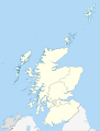
 Highlands and Islands 1999 (Scottish Parliament electoral region).svg 905 × 1,500; 845 KB
-
 Lothians 1999 (Scottish Parliament electoral region).svg 905 × 1,000; 845 KB
-
 Mid Scotland and Fife 1999 (Scottish Parliament electoral region).svg 905 × 1,000; 845 KB
-
 North East Scotland 1999 (Scottish Parliament electoral region).svg 905 × 1,000; 845 KB
-
 Scottish Parliamentary regions 2011.svg 1,023 × 1,345; 2.49 MB
-
 South of Scotland 1999 (Scottish Parliament electoral region).svg 905 × 1,000; 845 KB
-
 West of Scotland 1999 (Scottish Parliament electoral region).svg 905 × 1,000; 845 KB
.svg)
.svg)
.svg)
.svg)
.svg)
.svg)

.svg)
.svg)