Category:Maps of Snake Island (Black Sea)
Media in category "Maps of Snake Island (Black Sea)"
The following 22 files are in this category, out of 22 total.
-
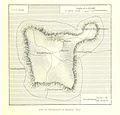 Karte der Schlangeninsel.jpg 1,686 × 1,622; 1.58 MB
-

-
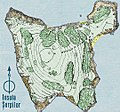 Insula Serpilor.jpg 539 × 502; 341 KB
-
 Schlangeninsel ro.png 636 × 683; 157 KB
-
 Schlangeninsel.png 636 × 683; 176 KB
-
 Battle of Snake Island (2022).png 1,661 × 826; 164 KB
-
 ICJ Romania v Ukraine.jpg 700 × 840; 89 KB
-
 ICJ Romania vs. Ukraine.svg 535 × 637; 442 KB
-
 Insula Serpilor map es.png 333 × 249; 18 KB
-
 Insula Serpilor map german.png 333 × 249; 8 KB
-
 Insula Serpilor map Masri-2.JPG 333 × 249; 12 KB
-
 Insula Serpilor map-ru.png 333 × 249; 9 KB
-
 Insula Serpilor map.png 333 × 249; 10 KB
-
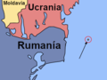
 Map of Ukraine political Snakes-Is.png 800 × 559; 135 KB
-
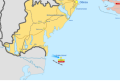 Snake Island campaign (2022).svg 475 × 317; 74 KB
-
 Stamps of Romania, 2014-10.jpg 1,142 × 783; 871 KB
-
 Txu-pclmaps-oclc-8322829 f 3.jpg 9,254 × 6,724; 19.41 MB
-
 Zmijsko ostrvo.PNG 333 × 249; 9 KB
-
 Добруджа в XX веке. Политическая география.png 433 × 600; 152 KB
-
 Змієвий острів.jpg 1,181 × 886; 473 KB
-
 Острів Зміїний (карта).jpg 636 × 683; 123 KB
-
 Острів Зміїний (рельєфна карта).jpg 539 × 502; 107 KB


.png)


.svg)


.jpg)
.jpg)