Category:Maps of St. Louis, Missouri
- 100 most populous cities of the United States
- 1–25
- Austin
- Boston
- Charlotte
- Chicago
- Columbus
- Dallas
- Denver
- El Paso
- Fort Worth
- Houston
- Indianapolis
- Jacksonville
- Los Angeles
- Nashville
- New York City
- Oklahoma City
- Philadelphia
- Phoenix
- Portland
- San Antonio
- San Diego
- San Francisco
- San Jose
- Seattle
- Washington, D.C.
- 26–50
- Arlington
- Atlanta
- Bakersfield
- Colorado Springs
- Detroit
- Fresno
- Kansas City
- Las Vegas
- Long Beach
- Louisville
- Memphis
- Miami
- Minneapolis
- Oakland
- Omaha
- Raleigh
- Sacramento
- Tucson
- Tulsa
- 51–75
- Anaheim
- Anchorage
- Cincinnati
- Cleveland
- Corpus Christi
- Durham
- Greensboro
- Honolulu
- Irvine
- Jersey City
- Lexington
- Lincoln
- Newark
- New Orleans
- Orlando
- Pittsburgh
- Plano
- Saint Paul
- Santa Ana
- St. Louis
- Tampa
- 76–100
- Boise
- Buffalo
- Chesapeake
- Chula Vista
- Fort Wayne
- Laredo
- Lubbock
- Madison
- Norfolk
- Richmond
- Santa Clarita
- Scottsdale
- St. Petersburg
- Spokane
- Toledo
- Winston-Salem
- >100 (former top 50 and still over 100.000)
- Cambridge
- Grand Rapids
- Hartford
- Lowell
- Providence
- Rochester
- Syracuse
- Worcester
Counties of Missouri: Adair · Andrew · Atchison · Audrain · Barry · Barton · Bates · Benton · Bollingern · Boone · Buchanan · Butler · Caldwell · Callaway · Camden · Cape Girardeau · Carroll · Carter · Cass · Cedar · Chariton · Christian · Clark · Clay · Clinton · Cole · Cooper · Crawford · Dade · Dallas · Daviess · DeKalb · Dent · Douglas · Dunklin · Franklin · Gasconade · Gentry · Greene · Grundy · Harrison · Henry · Hickory · Holt · Howard · Howell · Iron · Jackson · Jasper · Jefferson · Johnson · Knox · Laclede · Lafayette · Lawrence · Lewis · Lincoln · Linn · Livingston · Macon · Madison · Maries · Marion · McDonald · Mercer · Miller · Mississippi · Moniteau · Monroe · Montgomery · Morgan · New Madrid · Newton · Nodaway · Oregon · Osage · Ozark · Pemiscot · Perry · Pettis · Phelps · Pike · Polk · Pulaski · Putnam · Ralls · Randolph · Ray · Reynolds · Ripley · Saline · Schuyler · Scotland · Scott · Shannon · Shelby · St. Charles · St. Clair · St. Francois · St. Louis · Ste. Genevieve · Stoddard · Stone · Sullivan · Taney · Texas · Vernon · Warren · Washington · Wayne · Webster · Worth · Wright · Independent citiy: St. Louis
Wikimedia category | |||||
| Upload media | |||||
| Instance of | |||||
|---|---|---|---|---|---|
| Category combines topics | |||||
| St. Louis | |||||
independent city in Missouri, United States  .jpg)     Saint Louis i Missouri | |||||
| Instance of | |||||
| Named after | |||||
| Location | Missouri | ||||
| Located in or next to body of water | |||||
| Head of government |
| ||||
| Inception |
| ||||
| Population |
| ||||
| Area |
| ||||
| Elevation above sea level |
| ||||
| Different from | |||||
| official website | |||||
 | |||||
Subcategories
This category has the following 7 subcategories, out of 7 total.
E
Media in category "Maps of St. Louis, Missouri"
The following 41 files are in this category, out of 41 total.
-

-
 (St. Louis. LOC 75694664.jpg 3,152 × 2,912; 1.06 MB
-
 (St. Louis. LOC 75694664.tif 3,152 × 2,912; 26.26 MB
-
-
 1852 Colton Sectional Pocket Map of Illinois - Geographicus - Illinois-colton-1852.jpg 4,015 × 6,000; 6.62 MB
-

-
 1856 chicago st. louis.jpg 5,152 × 4,316; 6.5 MB
-

-

-

-

-
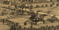 Cheltenham Fireclay Works.tiff 2,203 × 1,126; 9.47 MB
-
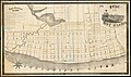
 Citygarden map.jpg 1,220 × 566; 199 KB
-
 EB9 St Louis - central layout.jpg 830 × 1,473; 756 KB
-
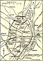 EB9 St Louis - city and vicinity.jpg 613 × 869; 222 KB
-
 Kirkwood-map.gif 575 × 425; 80 KB
-
 Map of Missouri highlighting Saint Louis City.svg 5,812 × 5,110; 112 KB
-
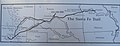 Map of Trail P5310482.jpg 2,629 × 1,000; 295 KB
-
 MOMap-doton-Saint Louis.png 300 × 263; 13 KB
-
 Navigable rivers near St Louis MO.svg 779 × 832; 116 KB
-
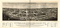 Panorama of the World's Fair, St Louis, 1904. LOC 97683596.jpg 12,512 × 5,824; 11.42 MB
-
 Partition of land of Auguste Chouteau. In U.S. Survey no. 363.jpg 7,982 × 4,262; 9.88 MB
-
 Pictorial St. Louis Pl. 97.tiff 5,856 × 4,032; 67.56 MB
-
 Plan of the city of St. Louis, Mo. (Detail showing Chouteau's Pond.).jpg 5,792 × 8,688; 15.1 MB
-
 Race and ethnicity 2010 St. Louis.png 3,009 × 3,009; 1.71 MB
-
 Race and ethnicity St. Louis (2000).png 3,009 × 3,009; 4.49 MB
-
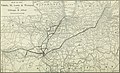
 Rail Bridges in St. Louis and Surrounding Area 1910.jpg 1,757 × 2,253; 2.27 MB
-
 Saint Louis in 1896. LOC 75694662.jpg 12,256 × 8,160; 22.31 MB
-
 SaintLouis1790s.jpg 546 × 406; 60 KB
-
 St Louis Birdseye Map 1896.jpg 10,753 × 6,999; 14.21 MB
-
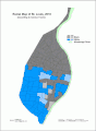
 St louis city parks map.jpg 10,044 × 12,432; 8.16 MB
-
 St Louis Rivers.png 180 × 202; 6 KB
-
 St. Louis printable tourist attractions map.jpg 2,105 × 1,488; 1.52 MB
-
 St.Louis-map.jpg 1,654 × 1,165; 313 KB
-
 Stlouis1780.jpeg 1,107 × 699; 205 KB
-
 StLouis2010TractsRace.gif 640 × 874; 45 KB
-
 Survey of Upper Louisiana District of St. Louis of Illinois, 1803.jpg 8,768 × 5,400; 9.03 MB
-
 The Commercial and financial chronicle (1910) (14761136641).jpg 4,212 × 2,560; 2.97 MB
-
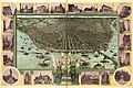
 The panorama of St. Louis. LOC 75694660.jpg 8,096 × 5,664; 5.8 MB
-
 TowerGrovePark-StLouis-MO-1883-PlanOfTGP-HABS-HAER-099057pu.jpg 4,462 × 1,538; 1.4 MB
-
 Webster-groves-map.gif 575 × 425; 82 KB
.jpg)


.jpg)
.jpg)
%27_(11006405145).jpg)
.jpg)


.jpg)

.png)


_(14761136641).jpg)

