Category:Maps of Stellwagen Bank
Media in category "Maps of Stellwagen Bank"
The following 3 files are in this category, out of 3 total.
-
 Admiralty Chart No 1227 Portsmouth Harbour to Boston Harbour, Published 1960.jpg 11,125 × 16,257; 55.39 MB
-
 Preliminary Chart of Stellwagen's Bank, 2nd edition, 1855.jpg 5,583 × 6,019; 49 MB
-
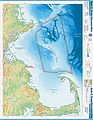 Stellwagen Bank NMS map.jpg 2,000 × 2,581; 538 KB


