Category:Maps of Summit County, Utah (style A)
Media in category "Maps of Summit County, Utah (style A)"
The following 10 files are in this category, out of 10 total.
-
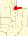 Map of Utah highlighting Summit County.svg 4,457 × 5,566; 56 KB
-
 UTMap-doton-Coalville.PNG 238 × 300; 18 KB
-
 UTMap-doton-Francis.PNG 238 × 300; 18 KB
-
 UTMap-doton-Henefer.PNG 238 × 300; 18 KB
-
 UTMap-doton-Kamas.PNG 238 × 300; 18 KB
-
 UTMap-doton-Oakley.png 238 × 300; 18 KB
-
 UTMap-doton-ParkCity.PNG 238 × 300; 18 KB
-
 UTMap-doton-Samak.PNG 238 × 300; 18 KB
-
 UTMap-doton-SummitPark.PNG 238 × 300; 18 KB
-
 UTMap-doton-Woodland.PNG 238 × 300; 18 KB


