Category:Maps of Tenerife

Islands of the Canary Islands: Chinijo Archipielago · Fuerteventura · La Gomera · Gran Canaria · El Hierro · Lanzarote · La Palma · Tenerife
Wikimedia category | |||||
| Upload media | |||||
| Instance of | |||||
|---|---|---|---|---|---|
| Category combines topics | |||||
| Tenerife | |||||
largest island of the Canary Islands  Vistes de Tenerife    | |||||
| Instance of |
| ||||
| Part of | |||||
| Location | Atlantic Ocean, international waters | ||||
| Located in or next to body of water | |||||
| Highest point |
| ||||
| Population |
| ||||
| Area |
| ||||
| Elevation above sea level |
| ||||
| official website | |||||
 | |||||
Subcategories
This category has the following 11 subcategories, out of 11 total.
!
*
- Old maps of Tenerife (15 F)
A
- Maps of Arona (Tenerife) (3 F)
G
- Geological maps of Tenerife (3 F)
L
M
- Maps of Buenavista del Norte (5 F)
- Maps of Icod de los Vinos (6 F)
S
- Maps of Santiago del Teide (4 F)
T
Media in category "Maps of Tenerife"
The following 33 files are in this category, out of 33 total.
-
 Areametropolitana Tenerife.jpg 222 × 193; 18 KB
-
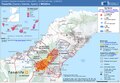
 Atmospheric conditions in Tenerife.jpg 1,949 × 693; 533 KB
-
 Barranco Tafuriaste, sendero turístico, 1.jpeg 960 × 1,280; 323 KB
-
 ECDM 20230817 WF Tenerife.pdf 1,625 × 1,125; 625 KB
-
 Espacios protegidos Tenerife-dumb.png 640 × 417; 96 KB
-
 Espacios protegidos Tenerife-en.png 640 × 417; 104 KB
-
 Espacios protegidos Tenerife.png 640 × 417; 258 KB
-
 Interferogram of Tenerife, Spain.jpg 1,022 × 718; 272 KB
-
 Karte Gemeinden Teneriffa 2022.png 3,000 × 2,487; 672 KB
-
 Location map Spain Tenerife.png 796 × 697; 194 KB
-

-
 Mapalavictoria.png 535 × 427; 11 KB
-
 MapasenderoPR-TF2.png 171 × 125; 22 KB
-
 MapaSenderoPR-TF5.png 250 × 186; 40 KB
-
 Menceyatos 01.jpg 3,260 × 2,868; 285 KB
-
 Menceyatos 02.jpg 3,260 × 2,868; 287 KB
-
 Menceyatos de Tenerife.jpg 911 × 719; 69 KB
-
 Menceyatos.svg 596 × 529; 42 KB
-
 Micromeria glomerata topographic distribution map-es.svg 1,835 × 1,278; 437 KB
-
 Micromeria glomerata topographic distribution map.svg 409 × 483; 450 KB
-
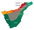
 Municipios y zonas de Tenerife.svg 1,024 × 768; 74 KB
-
 Parque rural de Anaga topographic location map.svg 409 × 483; 432 KB
-
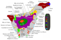
 Repartición alcaldías de Tenerife 2019 corregido.png 765 × 596; 241 KB
-
 Repartición alcaldías de Tenerife 2019.png 765 × 596; 248 KB
-
 Tenerife (Canary Islands) - OSM Mapnik.svg 2,660 × 2,239; 9.39 MB
-
 Tenerife kaart.svg 2,306 × 1,871; 157 KB
-
 Tenerife municipios.svg 200 × 200; 22 KB
-
 Tenerife preconquista.png 667 × 554; 134 KB
-
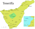
 Teneriffa map-en.svg 2,306 × 1,871; 154 KB
-
 Teneriffa map-es.svg 2,306 × 1,871; 154 KB
-
 Teneriffa map.svg 2,306 × 1,871; 154 KB
-
 TF Canarias.png 227 × 97; 4 KB
-
 TF Canaries.png 227 × 97; 3 KB


_-_OSM_Mapnik.svg)


