Category:Maps of Upper Nile
Media in category "Maps of Upper Nile"
The following 14 files are in this category, out of 14 total.
-
 A'li an-Nil.PNG 446 × 350; 41 KB
-
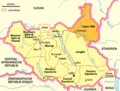 Karte Südsudan Upper Nile.png 1,500 × 1,133; 191 KB
-
 Map Upper Nile State.png 382 × 272; 116 KB
-
 Sud Sodan - Estats del Nòrd.svg 718 × 988; 325 KB
-
 Sudan-karte-politisch-aali-an-nil.png 624 × 411; 190 KB
-
 SSudan-UN.png 860 × 637; 18 KB
-
 A'ali an-Nil Sudan map with districts.svg 744 × 1,052; 155 KB
-
 A'ali an-Nil Sudan map with districts2.svg 744 × 1,052; 155 KB
-
 A'ali an-Nil district map overview.svg 744 × 1,052; 66 KB
-
 Upper Nile Administrative Map-sr.svg 718 × 988; 333 KB
-
 Upper Nile in South Sudan (+Kafia Kingi).svg 1,561 × 1,133; 422 KB
-
 Upper Nile in South Sudan.svg 1,561 × 1,133; 422 KB
-
 Upper Nile Map.svg 1,561 × 1,133; 211 KB
-
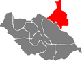
 Upper Nile State Counties.svg 303 × 367; 120 KB


.svg)


