Category:Maps of Vauhallan
Wikimedia category | |||||
| Upload media | |||||
| Instance of | |||||
|---|---|---|---|---|---|
| Category combines topics | |||||
| Vauhallan | |||||
commune in Essonne, France    | |||||
| Instance of | |||||
| Location | |||||
| Head of government |
| ||||
| Population |
| ||||
| Area |
| ||||
| official website | |||||
 | |||||
Media in category "Maps of Vauhallan"
The following 12 files are in this category, out of 12 total.
-
 91 Communes Essonne Vauhallan.png 723 × 750; 166 KB
-
 91635-Vauhallan - Localisation.png 2,500 × 2,480; 1,016 KB
-
 91635-Vauhallan-cadastre.png 7,015 × 4,960; 5.48 MB
-
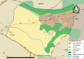
 91635-Vauhallan-géologie.png 7,015 × 4,960; 4.53 MB
-
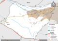
 91635-Vauhallan-Hydro.jpeg 5,846 × 4,133; 1.54 MB
-
 91635-Vauhallan-Hydro.png 7,015 × 4,960; 4.42 MB
-
 91635-Vauhallan-Natura 2000.png 7,015 × 4,960; 2.49 MB
-
 91635-Vauhallan-Orthophoto.png 7,015 × 4,960; 2.47 MB
-
 91635-Vauhallan-sols.png 7,015 × 4,960; 4.66 MB
-
 91635-Vauhallan-ZNIEFF1.png 7,015 × 4,960; 2.51 MB
-
 91635-Vauhallan-ZNIEFF2.png 7,015 × 4,960; 2.51 MB
-
 Map commune FR insee code 91635.png 756 × 605; 30 KB


