Category:Maps of Ventotene island
Media in category "Maps of Ventotene island"
The following 7 files are in this category, out of 7 total.
-
 Isole Pontine.png 1,370 × 827; 120 KB
-
 Mappa Area naturale marina protetta Isole di Ventotene e Santo Stefano.png 1,056 × 816; 70 KB
-
 Mappa Riserva naturale statale Isole di Ventotene e Santo Stefano.png 1,056 × 816; 70 KB
-
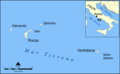 Pontine Islands map ita.png 800 × 494; 85 KB
-
 Pontine Islands map.png 800 × 494; 113 KB
-
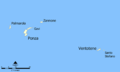
 Ventotene.png 1,400 × 793; 99 KB
-
 Ventotene.svg 1,052 × 1,198; 81 KB


