Category:Maps of Victoria Island, Canada
Media in category "Maps of Victoria Island, Canada"
The following 14 files are in this category, out of 14 total.
-
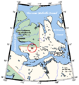
 Chart of the Arctic Coast, examined by J. Rae in 1851.png 4,541 × 2,096; 25.03 MB
-
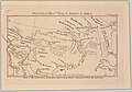 Discoveries of Messrs. Dease and Simpson in 1838-9 (14166789030).jpg 2,500 × 1,745; 1.78 MB
-
 Map indicating Victoria Island, northern Canada.png 428 × 380; 67 KB
-
 Ocean Arctic - Localizacion de l'Ila Victòria.png 975 × 1,005; 483 KB
-
 Victoria Island Canada Paker's Notch.png 1,229 × 1,109; 192 KB
-
 Victoria Island de.svg 668 × 536; 368 KB
-
 Victoria Island, Canada.svg 1,084 × 920; 51 KB
-
 Victoria Island.png 668 × 536; 127 KB
-
 Victoria Island.svg 573 × 499; 138 KB
-
 Victoria ostrov.png 1,280 × 1,063; 54 KB
-
 Victoriaisland.png 320 × 329; 11 KB
-
 VictoriaIslandMap Parker's Notch.png 504 × 540; 27 KB
-
 VictoriaIslandMap.png 504 × 540; 27 KB
-
 Острво Викторија.svg 668 × 536; 1.1 MB

.jpg)


